Cruising is a challenging lifestyle but it gets easier the more you know. Here are some things we learned from our year onboard traveling from the Great Lakes, through the Erie Canal, down the East Coast and to the Bahamas.
General Cruising Lessons:
Take the weather windows you get
This may seem obvious but it is not. We talked to many cruisers who stayed in the marina or anchorage afraid to move because another storm was coming in a day or two or for whatever other reason they gave. If the passage takes a day and you get the wind and weather for a day, you take it because it may not come around again for a while.
This may mean you motor through a calm instead of waiting for your perfect wind to sail. Our gulf stream crossing back to the U.S is a great example. We had settled weather then a night of strong winds and storms followed by another two days of calm. After that calm the forecast showed strong winds for several days followed by strong winds for several more days in another direction. We took the calm window, mostly motoring across back to the U.S. We were so glad we did because as we watched friends wait for their window and watched the wind and wave forecast there wasn’t another window for a while.
2. Don’t leave as the blow is dying- it won’t die as quickly as forecast
This lesson we learned so many times! You look at the forecast and see that the strong wind should be dying starting at say 11 am so you leave just after that. It may seem like the wind is really dying from your anchorage but once you are out there, you realize it isn’t. Then your sailing in heavier wind and waves than you wanted. So many times, if we had just waited a bit longer we would have had a more comfortable passage.
3. Amazon Lockers/Shipping to Marinas
We thought shipping things from Amazon to Amazon lockers would be easier. We found that unless the item is fulfilled by Amazon it won’t qualify to be shipped to a locker. Most boat parts or other random items we found ourselves in need of were not fulfilled by Amazon so the lockers weren’t an option. What we did find is that most marinas will let you ship something to them even if your not staying in a slip. We typically anchored wherever we went but the marinas don’t care or don’t track who is shipping items so we never had an issue. Just make sure to put your name and boat name on the package.
4. Catamarans and Monohauls act differently in current- anchor next to your own kind
We rode out many blows on anchor, often in places with strong tidal current. We learned quickly that catamarans will typically face the wind but monohauls will move with the current. Some monohauls will kind of sail around on anchor when its really windy. Our boat tends to do this alot so we need a fairly large radius if we are in an anchorage with strong current and strong winds are forecast. Its a good idea to stay onboard and see how the boats around you react when the current switches to make sure you are good before heading to shore.
U.S East Coast:
Avoid Publix for your groceries
Our entire way down the coast we headed to whatever grocery store was the closest/walkable form the dinghy dock. As we got into the southern states that seemed to most often be a Publix. Wow were we shocked by how expensive everything was! On average our grocery bill for 1-2 weeks of groceries went up 25-30% compared to what we were used to spending at home (going to Meijer in Michigan). Our first shopping trip back in the U.S we used Instacart for Aldi and we were very pleasantly surprised by how much cheaper it was. We assumed using Instacart and paying the service and delivery fees would make that option more expensive but depending on what store you shop at that isn’t always the case. We continued to use instacart our entire way up the coast, mostly from Aldi stores and each time we found it much cheaper.
2. Noreasters
Wow! we knew noreasters were a think on the east coast but we didn’t realize how often they can occur. We had a pretty big blow/storm blow through nearly every week. It forced us inside, taking the ICW much of the way south.
3. Get at least one water jerry can, even if you have a water maker
We found this to be super helpful. Often the water isn’t very clean/clear so being able to top off along the way and not solely rely on our water maker saved us several times.
4. Not all towns, marinas along the ICW are cruiser/dinghy friendly
Not to say that people weren’t friendly and welcoming but not every town will have a dingy dock so you may find yourself struggling to figure out where to safely leave the dinghy if you want to go to shore for the day.
5. Being from Mi we didn’t realize how good we have it with our marina fees. We were not prepared for how expensive marinas are along the east coast and then you are often charged separately for power and water. We knew marinas would be expensive and we didn’t stay in them often. But it was a bit of sticker shock every time we did go into the dock.
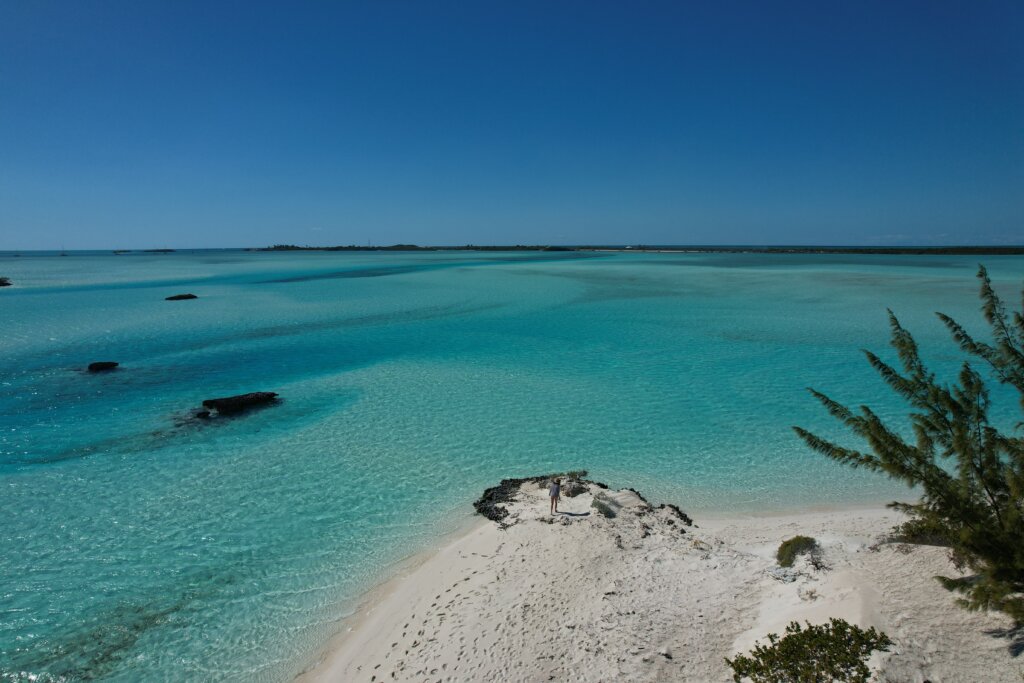
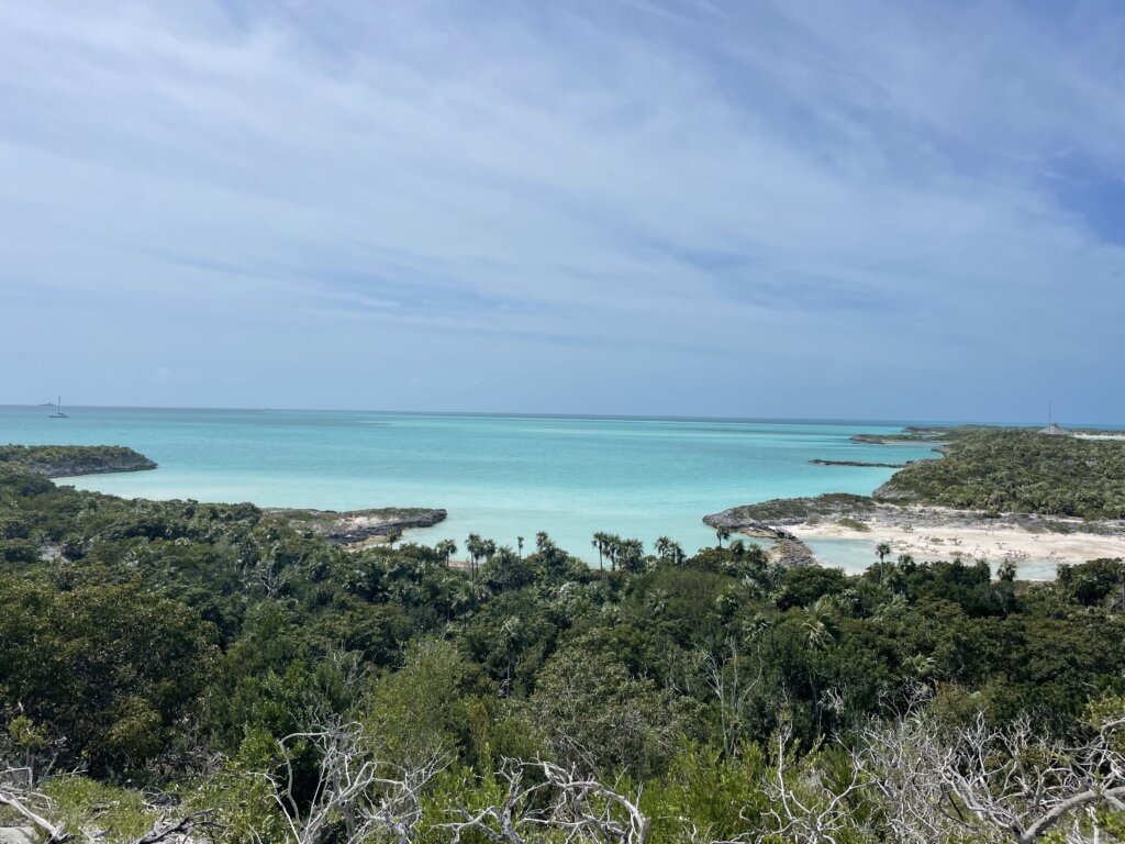
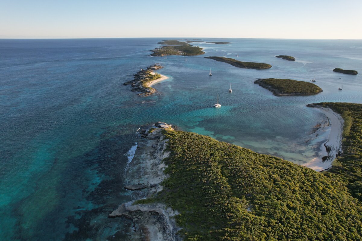
Bahamas:
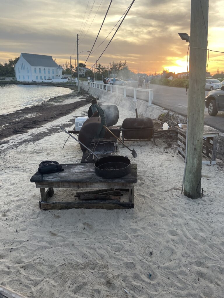
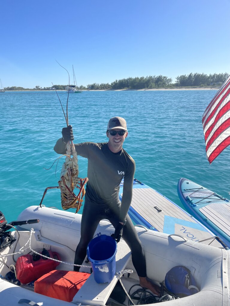
Get a handline for fishing, they are cheap and work super well!
2. Stock your pantry well all non-perishables before you go. While we found pantry items available in stores more often than we anticipated they were most often much more expensive than in the U. S so we were glad we didn’t have to buy them.
3. Know what day the supply ship stocks the grocery store. That day and maybe the day after there will be fresh fruits/veggies and dairy but if you go several days later it will likely be very picked over. Typically they are supplied once a week
Hopefully these tips help you along your cruising journey!
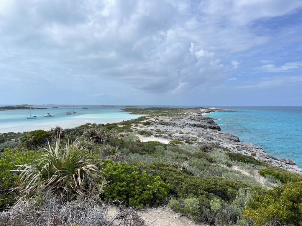
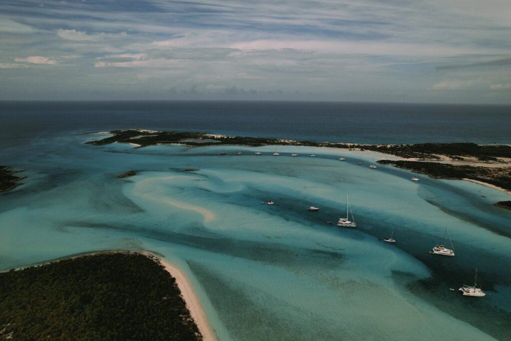
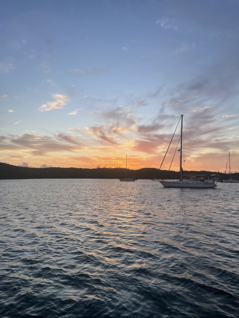
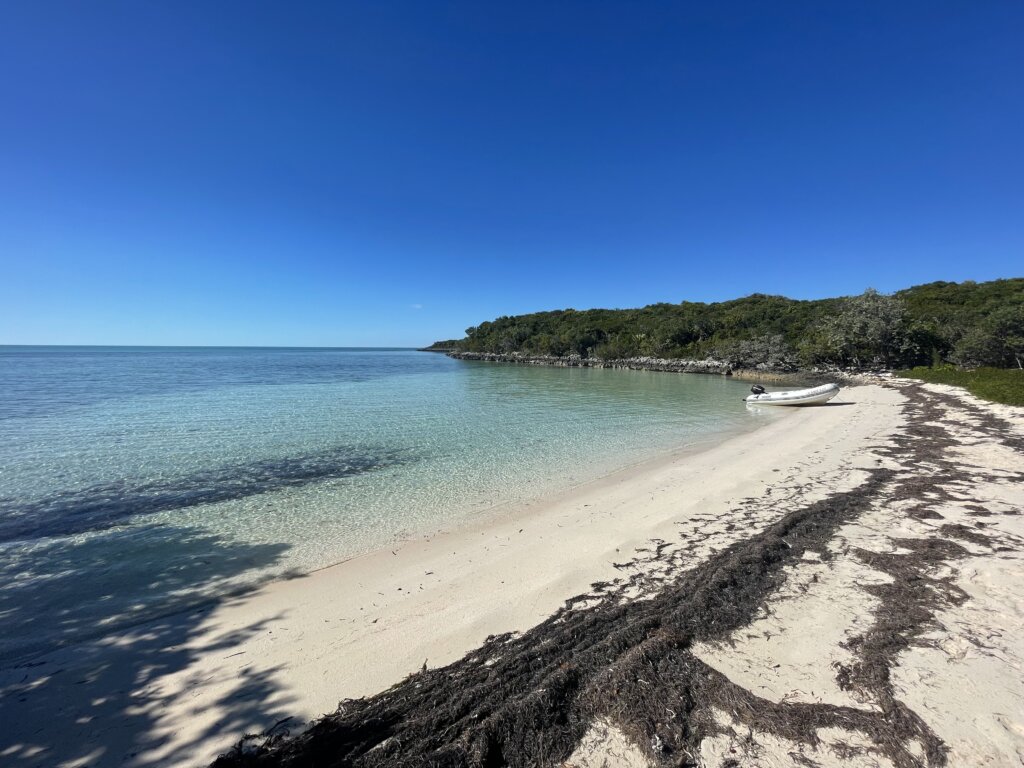
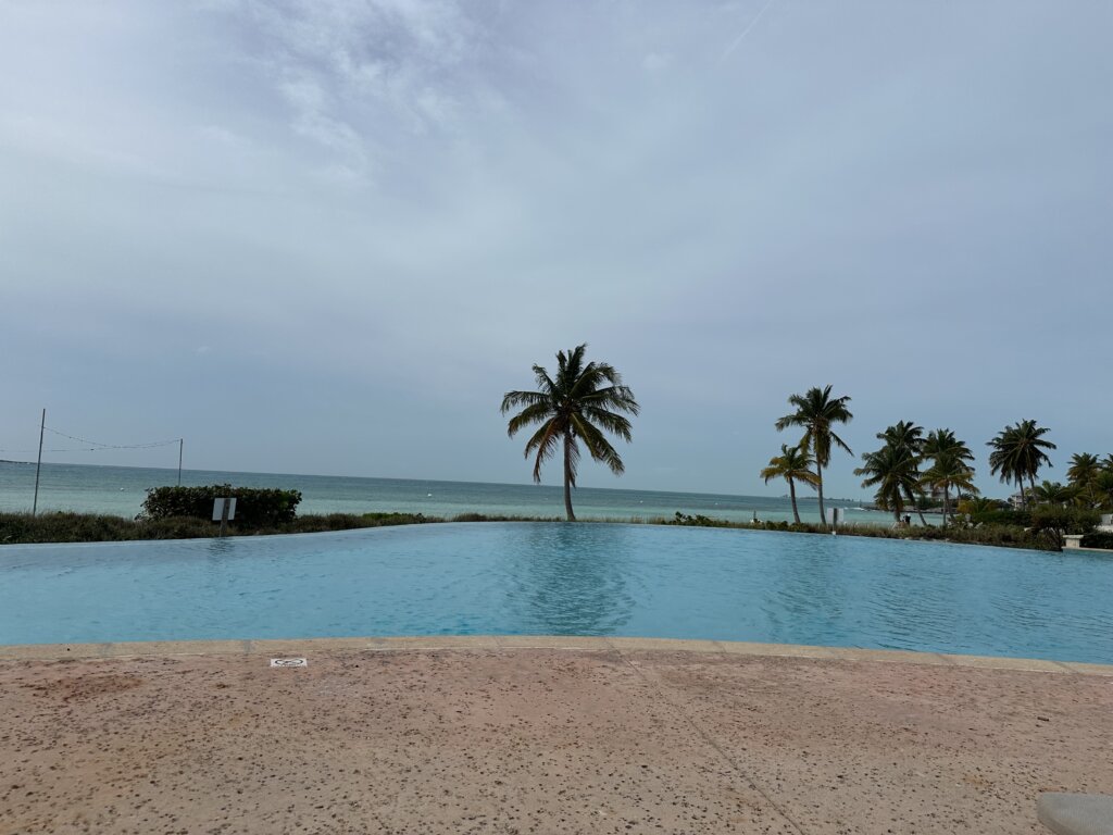
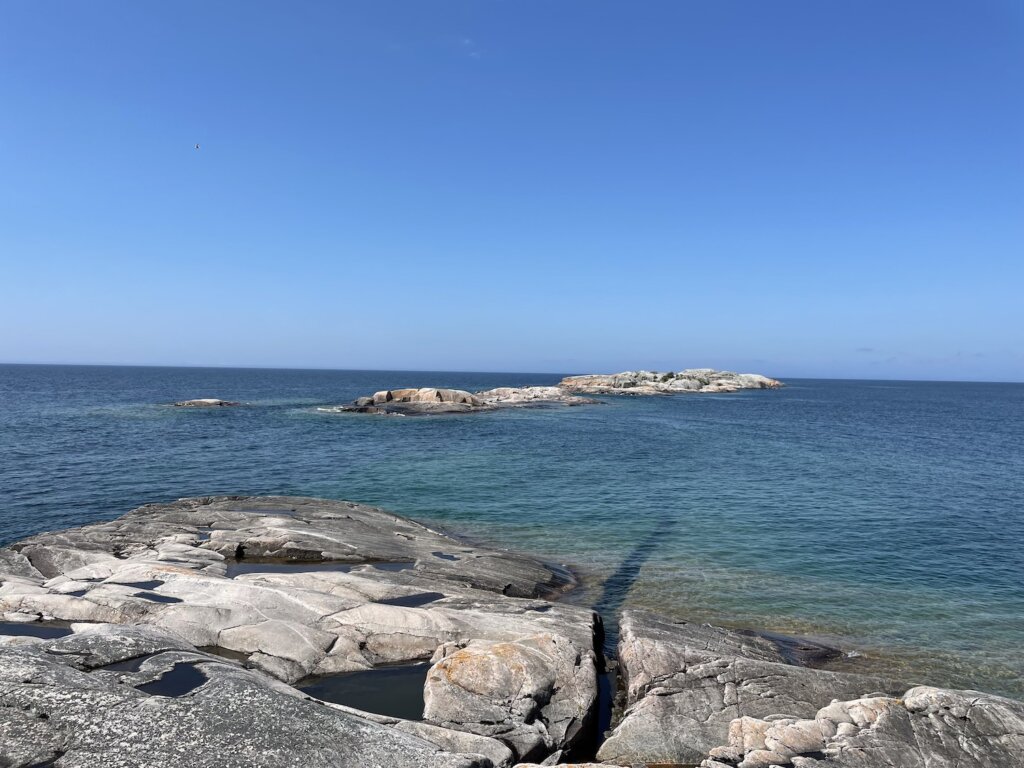
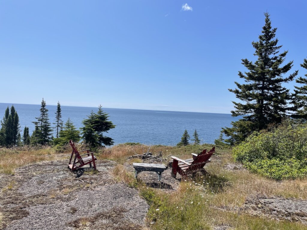
We visited the Abacos as the last island chain before crossing back to the U. S. Most of our cruising in the Bahamas we spent in the Berries, Eleuthera and the Exumas. The Abacos were a bonus for us on our way back north. We staged near Spanish Wells, at the Egg Island anchorage to cross north to the Abacos. The anchorage was pretty rolly but it was super easy to get up and sail right off anchor before sunrise.
We ended up having just short of two weeks in the Abacos before we had our window to cross the gulf stream. We certainly didn’t see everything there is in this island chain but we did enjoy the handful of stops we made.
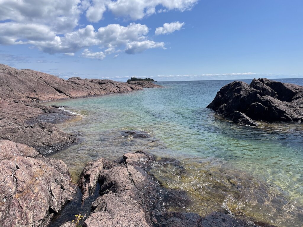
Lynyard Cay
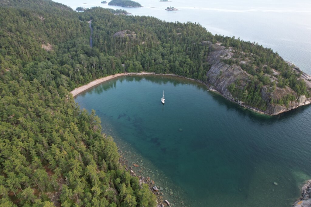
We landed in the Abacos and anchored at Lynard Cay. We draw 6 ft so we can’t get into Little Harbor and the bay near there, The Bright of Old Robinson was very rolly so we continued in a couple miles, out of the swell. There is a small beach on shore and we found some what of a hiking trail to get out and stretch our legs. The anchorage was quiet and calm.
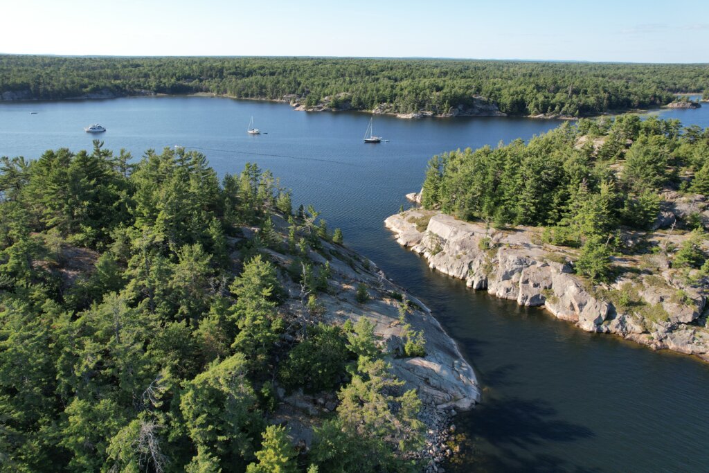
Snake Cay
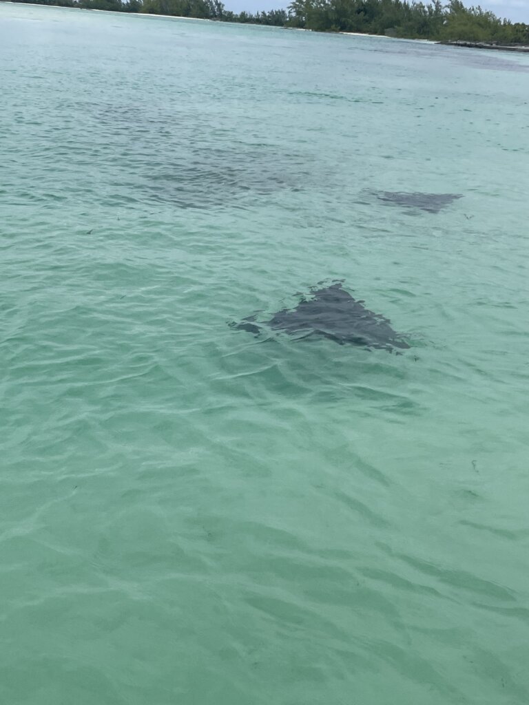
We stopped here for one night and enjoyed taking the dinghy through Snake Cut into the mangroves. We saw several eagle rays and turtles in the shallow waters. This was also the first time in the Bahamas that we had the anchorage all to ourselves!
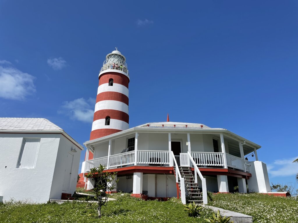
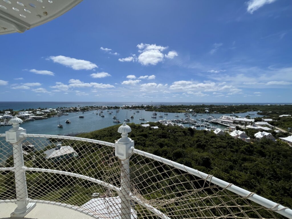
Hope Town
Our next stop was Hope Town. We found the water in the anchorages nearest to town to be pretty shallow. We anchored under the lighthouse for our first night in town. With the very low tide that happened we ended up touching bottom with our 6 ft draft so the following day we moved to anchor behind the Parrot Cays which was further out. The dinghy ride from there is just over a mile to town so it wasn’t too bad.
The town itself is super cute and we really enjoyed wandering around. We grabbed some ice cream and then headed to the grocery store. The store was not well stocked at all either time we visited. We were able to grab a couple veggies but not as many as we had hoped for.
Our final day in town we visited the lighthouse which is free to walk up. The views from the top are well worth the climb. Afterwards we treated ourselves to lunch at Cap’N Jacks which is right on the water. It was probably the best restaurant meal we had in the Bahamas and the prices were very reasonable. We finished off the night with a beach bonfire with some friends as a perfect end to our time in town.
Great Guana Cay
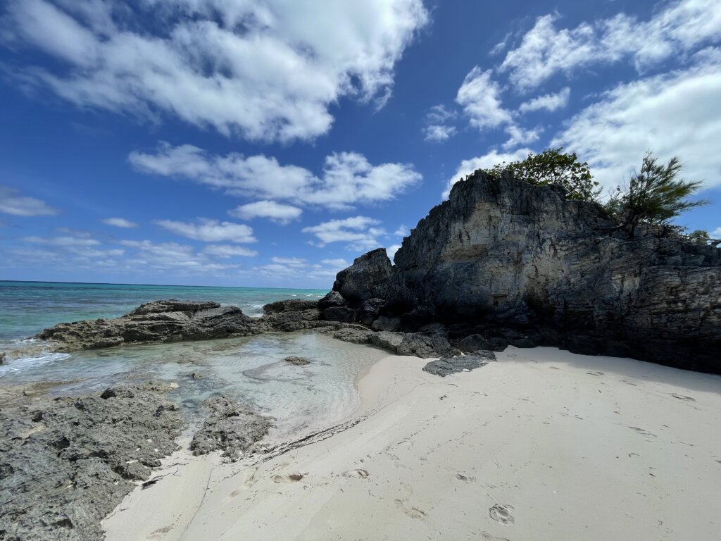
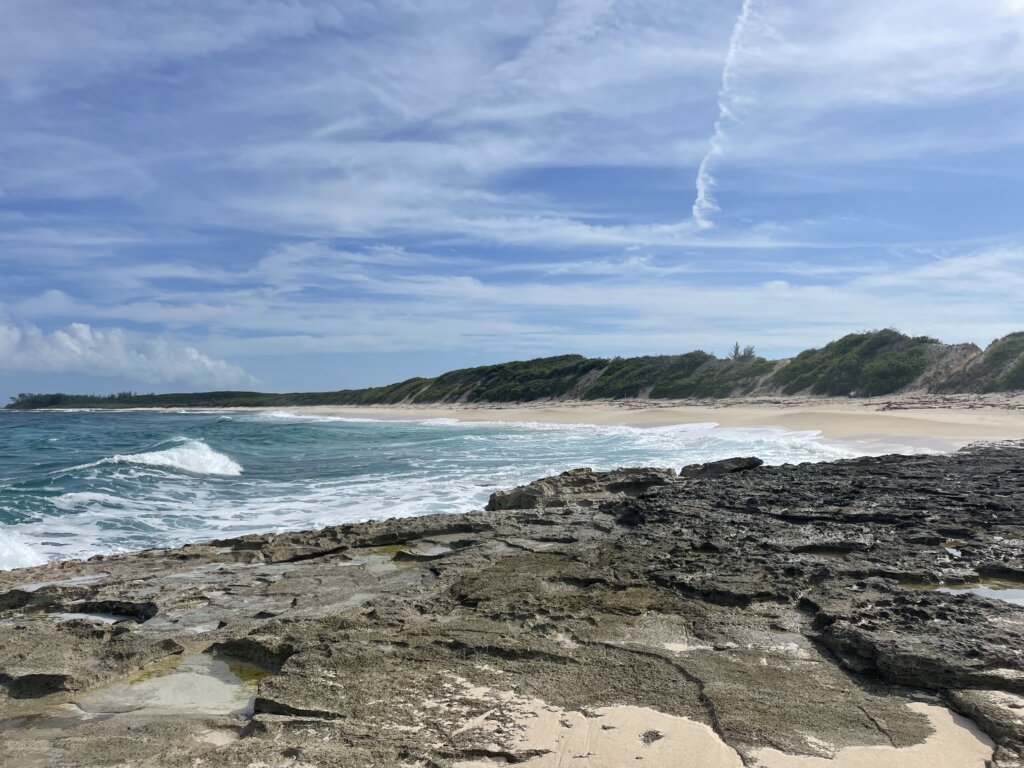
We headed north and stopped at Great Guana Cay. Anchored in Fisher’s Bay we had easy access to town. There are two beach restaurants here, Nippers and Grabbers. We didn’t eat at either but they both looked fun and were full of guests. There is a grocery store in town and a liquor store. The grocery store here was better stocked than in Hope Town. The beer at the liquor store was priced better than most other places we had seen. We really enjoyed the beach on the ocean side of the island. It is a huge beach with super soft sand and practically nobody else around.
Nunjack Cay
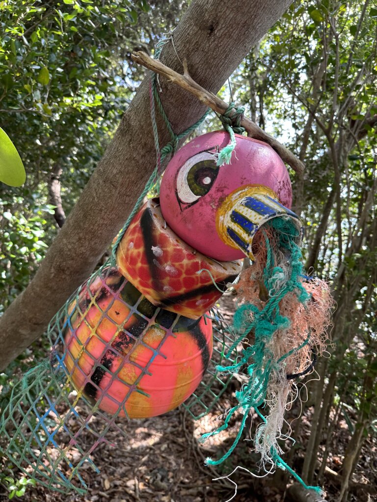
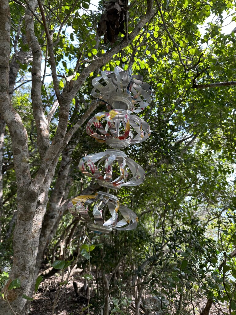
We skipped over Green Turtle and headed straight to Nunjack. We stayed here several nights. It had great north, northeast protection, okay south and southwest protection. There is plenty to see in this anchorage. We really enjoyed taking the dinghy through the mangroves to see the turtles. The nearby art trail is also nice to see. There is some creative art, mostly made with items washed up on the beaches.
To the north of the anchorage there is a nice trail system. There are a couple cottages on the island but they don’t mind if you walk the trails. The local tour boats also frequent this bay to feed the sharks and rays so you can see plenty of them as you walk the beach. If its calm on the outside, there is great spearfishing on the ocean side here.
From there, after the storms passed we had a window to cross back to the U.S. We headed for Allans/Pensacola Cay where we stayed the night before heading across the gulf stream. We didn’t go to shore at this anchorage but it looked really nice.
That concluded our 3 month cruising visa in the Bahamas. We certainly didn’t see everything but we felt 3 months gave us enough time to see quite a bit! Traveling through the Berry Islands, Eleuthera, the Exumas and ending with the Abacos was a great way to go! Hopefully we can cruise through again some day and hit some spots we missed this time around!
For more information on our time in the other island groups check out our posts below-
We had heard from several sailors that the Exumas are the best cruising ground in the Bahamas! We were super excited to make it to these islands. After spending just over a month in the Exumas we can now confirm! The Exumas are stunning and they have some much to offer!
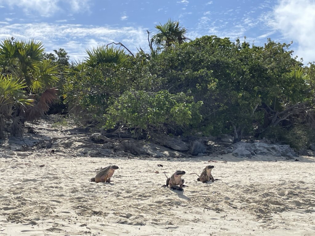
Allan Cay
This was our frist stop in the Exumas. We anchored in-between Allan and Leaf Cay. The area is stunning! There is strong current in this anchorage and the holding varies. There are sandy spots with fantastic holding but also spots with hard pack sand. We waited out a blow here and held just fine. Several charter boats came into the anchorage and one struggled to anchor and did end up dragging overnight. Be mindful and check your anchor set if you plan to stay here.
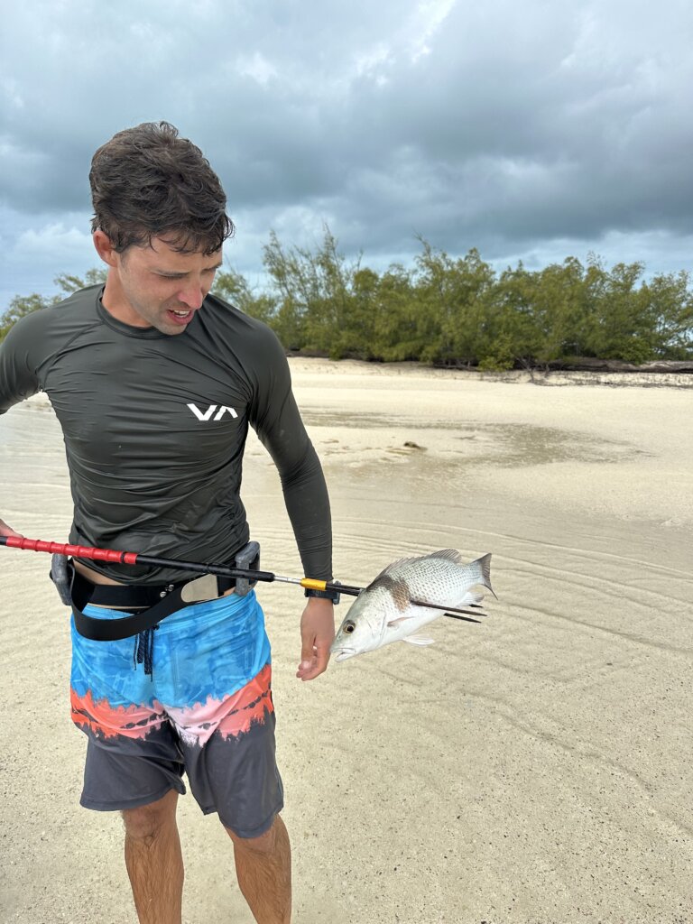
Inside the anchorage we found some really nice snorkeling. Ryan went spearfishing twice a day (at slack tide due to the strong current in the anchorage). He ended up getting several lion fish, snapper and grouper. The main attraction on Allan seems to be the Rock Iguanas. They are used to tourists feeding them so they will run up as you approach the beach. If you don’t have anything for them they will leave you alone. We did see a few tour boats come through each morning, drop people off for about a half hour then they would leave. You can have the beach to yourself or share with only other cruisers if you wait until after the tour boats clear out.
Norman’s Cay
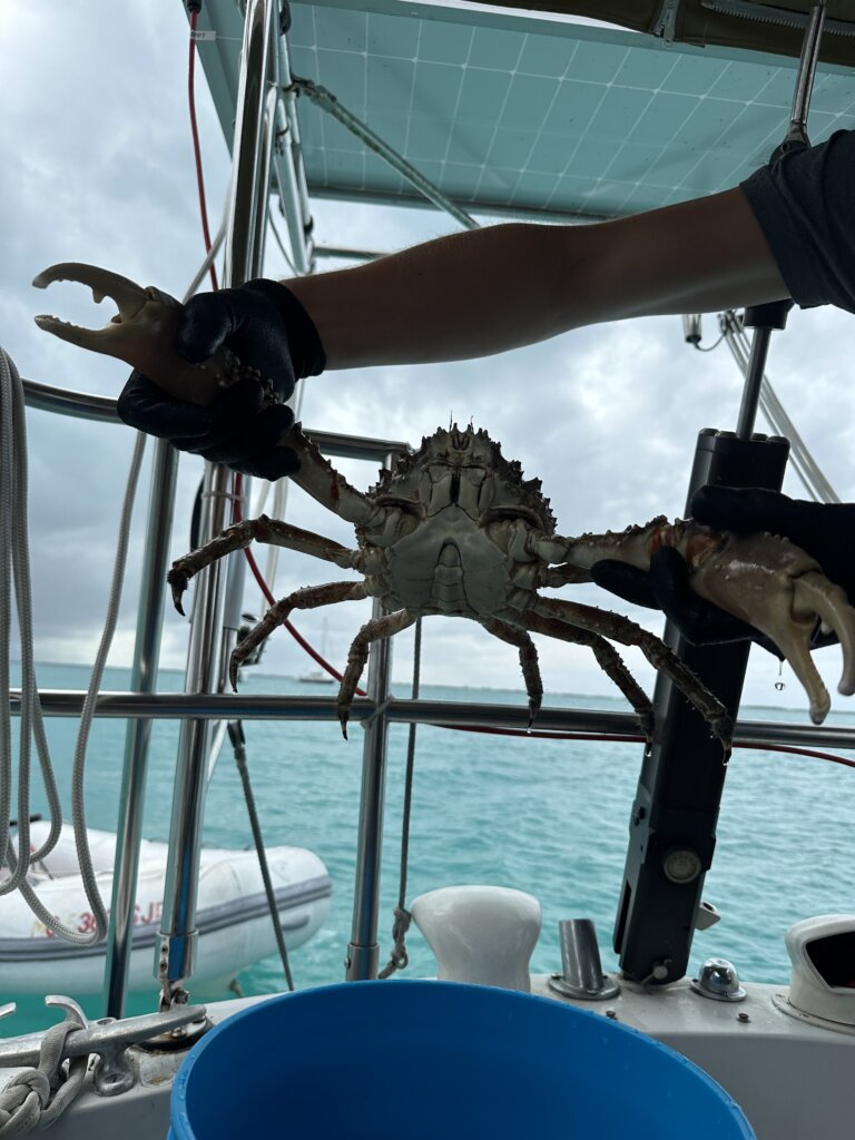
We anchored in the bay on the north east side of the island as we had west and north winds during our stay. The bay is beautiful and there is plenty of space to anchor with good holding. Along the whale tale at the edge of the bay is great spearfishing and snorkeling. We headed out that way a couple of times. We got a snapper, trigger fish, a crab and a lobster here. There is shallow snorkeling then it drops off to about 20-25 ft.
The must see item everyone talks about on Norman’s is the plane wreck. The plan is believed to have crashed in the 1980s by drug smugglers. It lays in shallow water and there are plenty of fish calling it home. Do be sure to go during slack time. Friends of ours said when they attempted the current was pretty strong. We went during slack and had nearly no current.
The beaches surrounding this anchorage are stunning. We took the dinghy around and found some really pretty spots. There are plenty of deep water channels then shallow spots and sandbars giving you all the beautiful and varying shades of blue.
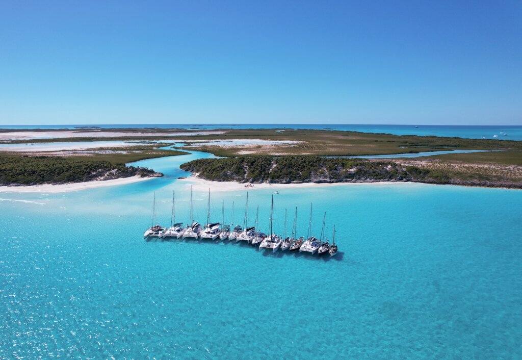
Shroud Cay
A visit to Shroud Cay is a must! But if you can time it with the Young Cruisers Association’s Floatchella event, than its even better. We rafted up 15 boats in total and then took the tide to float through the natural lazy river that flows through the island. The day we did this float the current wasn’t super strong so we didn’t float too far. But the previous day we took our paddle boards through on our own and paddled quite far. The mangrove lines channels flow all the way through to the other side of the island. The water is crystal clear and the scenery is stunning! We saw several turtles and a couple small lemon sharks along the way. Highly recommend visiting this island.
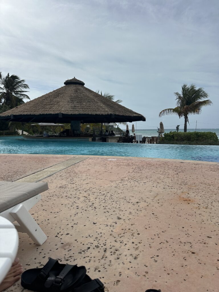
Big Majors Spot
We anchored just off from the famous pig beach at Big Majors Spot near Staniel Cay. The major attractions here are the pig beach, thunderball grotto and Staniel Cay Yacht Club.
To visit the grotto is is best to go at low, slack tide. This way you can enter the cave snorkeling/swimming with your head above water. If you plan to go at high tide you’ll have to swim underwater to reach the entrance. The current does move quickly through the cave, we were a bit late for slack tide and had to swim against current to enter. Once in the cave there are ropes to grab onto. Inside the cave, in the center area there is no current and you can swim around without worry. There are plenty of fish to see and the cave itself is really pretty! While there will be tour boats and it is a more crowded place to visit we really enjoyed it!
The pig beach wasn’t that exciting for us. Plenty of tour boats visit the pigs each day. They will swim out to the boats expecting food. We did take the dinghy over to see them and gave them some stale food from the pantry. The anchorage its self is nice and well-protected so its a great place to anchor and spend a few days but the pigs aren’t why you visit.
The day we visited the yacht club they happened to be hosting a wahoo fishing tournament. We arrived as they were weighing all the fish from the days catch. It was really cool to see the giant fish being brought in. the yacht club is an iconic stop for anyone cruising the Bahamas. It has a great atmosphere and a fantastic happy hour! The food was nothing special but the rum punch was great (2 for 1 at happy hour 4-6pm) and it was a great place to hang out with some fellow cruisers for the evening.
Black Point Settlement
We spent two days in Black Point. In town you will find a couple small grocery/convenience stores. The laundry in town is supposed to be one of the best in the Bahamas although we didn’t use it we have heard it is really nice. There are a couple restaurants to chose from. We were there during the Super Bowl. Every restaurant in town was having some type of special but we ended up at Lorraines for dinner, drinks and to watch the game. It was a fun place to hang out, many cruisers and locals showed up to watch the game.
The following day we went back to Lorraines to grab some local bread. They bake cinnamon, cinnamon raison, cinnamon raison coconut and plain white bread. It was so good and well worth the $10 a loft price. After walking through town you can head across the island to see the blow hole and from there walking along the beach there are lots of cool rock formations and beautiful beaches.
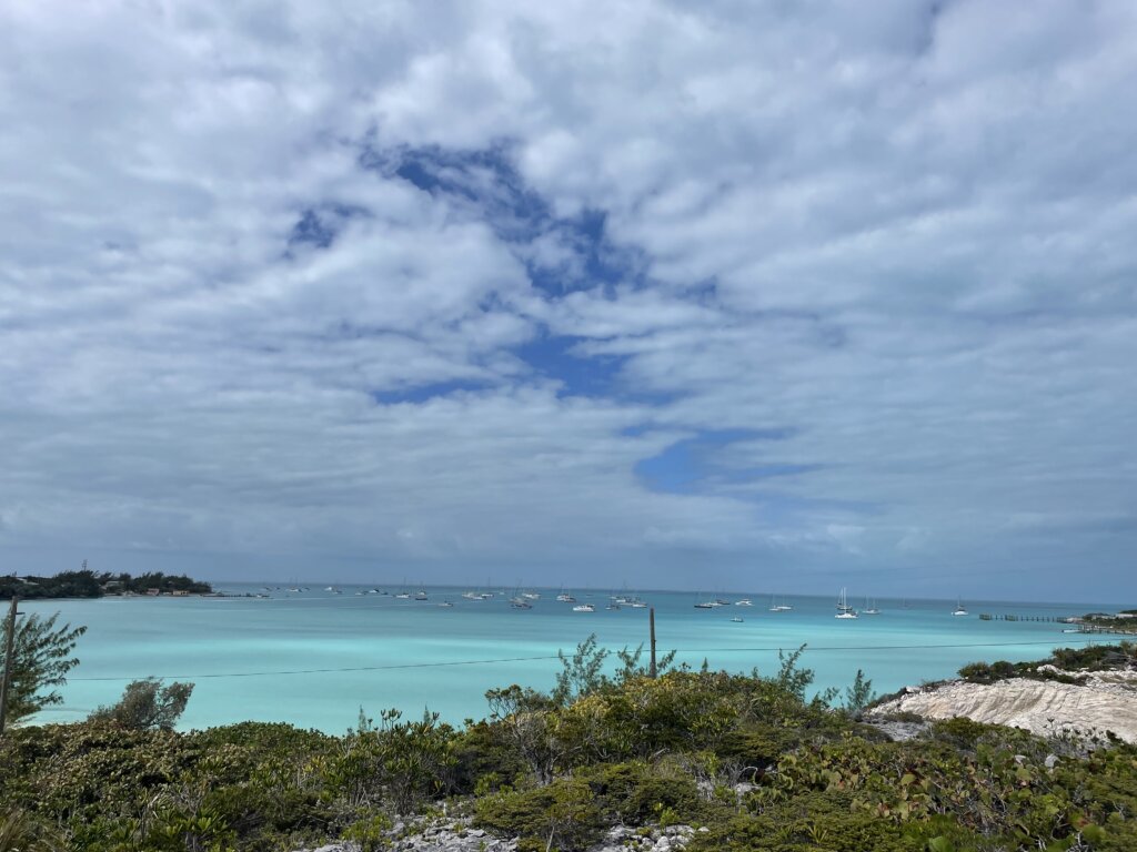
George Town
George Town is a huge cruising hub and many boats spend the entire season here. During our stay there were about 350-400 boats in the Harbor. We happened to be in town at the beginning of the 2024 cruising regatta. There were so many events taking place! We really enjoyed the cruisers junkanoo parade. The event showcased a couple local junkanoo groups and a group of cruisers. It was really fun to see all the costumes and be part of something the locals celebrate every year.
We anchored near Monument Beach on Stocking Island. The hiking trails on the island are really pretty and the beaches along the Exuma Sound/Atlantic side of the island are stunning!
Of course, no visit to George Town would be complete without spending some time at the Chat N Chill. Every Sunday they do a pig roast event that starts at noon. It is $25 a plate. Their normal/everyday menu features burgers, hot dogs, chicken and conch burgers. The beach has volley ball nets, yard games and plenty of tables in the shade. We always found someone we knew or we met new friends hanging out on the beach there.
In Town you will find groceries and two liquor stores right near the dingy dock. There is also a gas station, free RO water and trash. You can listen in on the cruisers net each morning at 8am on channel 72 for more details on what is happening in the harbor or to have any questions you have answered.
Our final day we took the dinghy south to Crab Cay. There is a man-made cut that you can take the dinghy through. The project was abandoned so it doesn’t go all the way through the island but it does go back pretty far. We enjoyed floating through and seeing the crabs along the tall rocky walls on either side.
On our way back North, through the Exumas we took our time and stopped at several anchorages we had passed on our way south to George Town.
Between Norman’s Pond and Leaf Cay
We both agreed this was one of our favorite anchorages. It is really pretty and there are tons of small beaches and rocky areas to explore. We spent our time spearfishing, exploring and just relaxing on the beaches.
Rudder Cut Cay
This is another stop we really enjoyed. Here you can snorkel around the piano and mermaid statue. We then snorkeled the shallow bay at Rudder Cut Beach where there are tons of sea turtles. The turtles don’t mind you swimming with them at all and many are quite large. Along the rocky edge of the bay we found plenty of small fish, a lemon shark, lobster and small corals. The other attraction nearby is a cave you can dingy into.
Oven Rock
We stopped here to see the cave with a salt water pool inside. If you are brave enough you can snorkel or cave dive in the water here. We did not, opting only to walk around the cave and check out the pool. It was really cool to see and worth a stop for an afternoon or night if you have time. The anchorage is just north of Big Farmer’s if you do need anything in town.
Little Bay (just south of Black Point)
We read this anchorage is typically pretty quiet, empty but we found plenty of other boats here the night we stayed. The beach here is one of the nicest we found. The white sand is super soft and the water is shallow, perfect for anchoring the dinghy off the beach and walking in. There isn’t much else here but you are just south of Black Point. It was a really pretty stop and we enjoyed it.
Fowl Cay
This anchorage is just outside of the Exuma Land and Sea Park. We anchored here to stop at Rachel’s Bubble Bath. The “bubble bath” was one of our favorite stops in the Exumas! After wading in through shallow river you arrive at this pool. When the wave crash over the rocks the foamy water in the pool give it a bubble bath/jacuzzi feel.
The anchorage also have great snorkeling in the north west corner. The other nearby attraction are the Rocky Dundas caves. There are mooring balls outside the caves to tie your dingy to. We went by to check it out but the waves and swell were up so we didn’t feel good about swimming into the caves. We were stopped by the park rangers on our way back to the anchorage and told that even if your anchored outside the park you are supposed to pay the fees if you enter the park- $14 per person per day.
The anchorage here was pretty rolly in 15-20 south east wind. We also found it to be pretty shallow. We anchored in enough water but at low tide the wind shifted directions to be out of the north as a squall went through. Once the boat shifted we were touching the bottom until thankfully the wind shifted back and we ended back in deeper water. We left first thing in the morning before the next low tide (we draw 6 ft).
O’Brian’s Cay
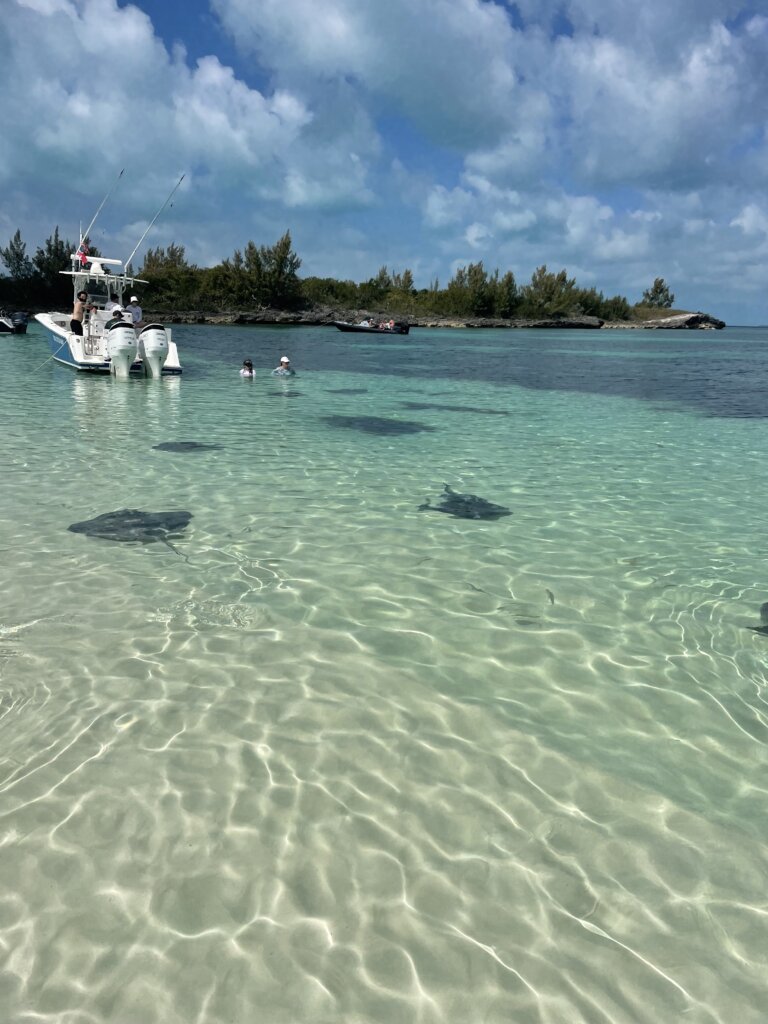
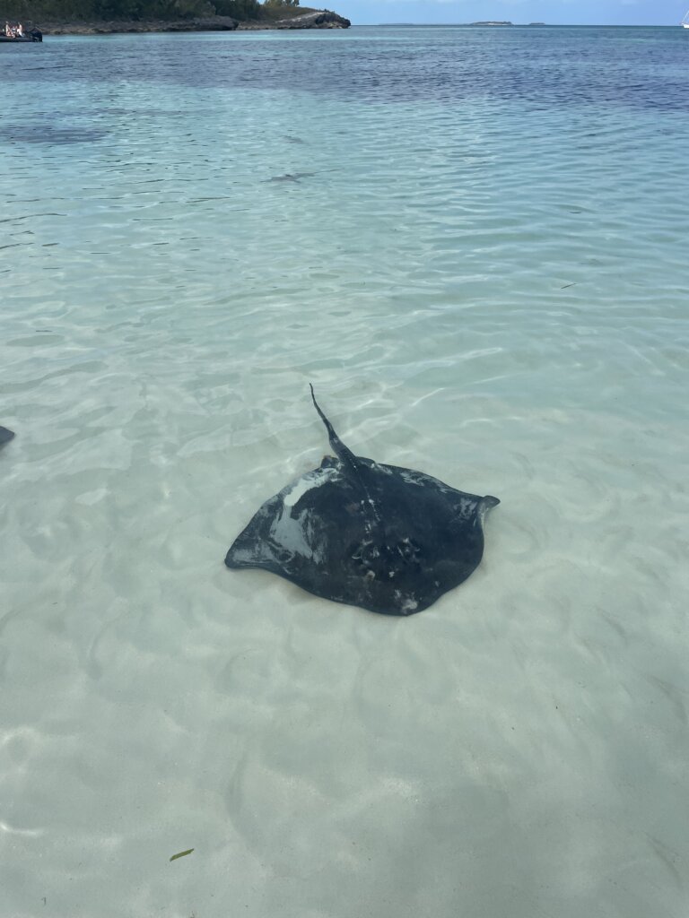
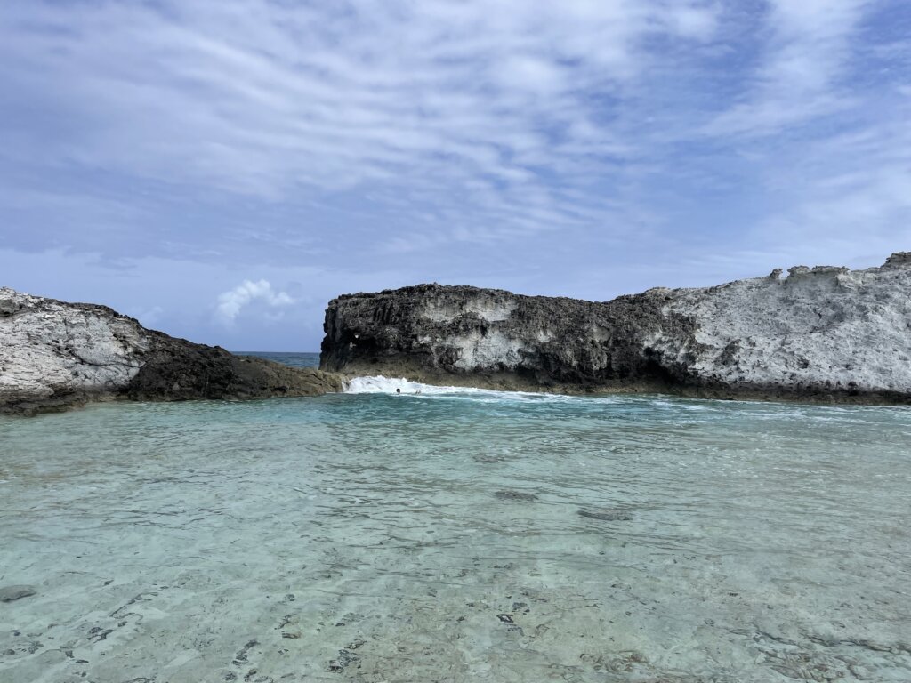
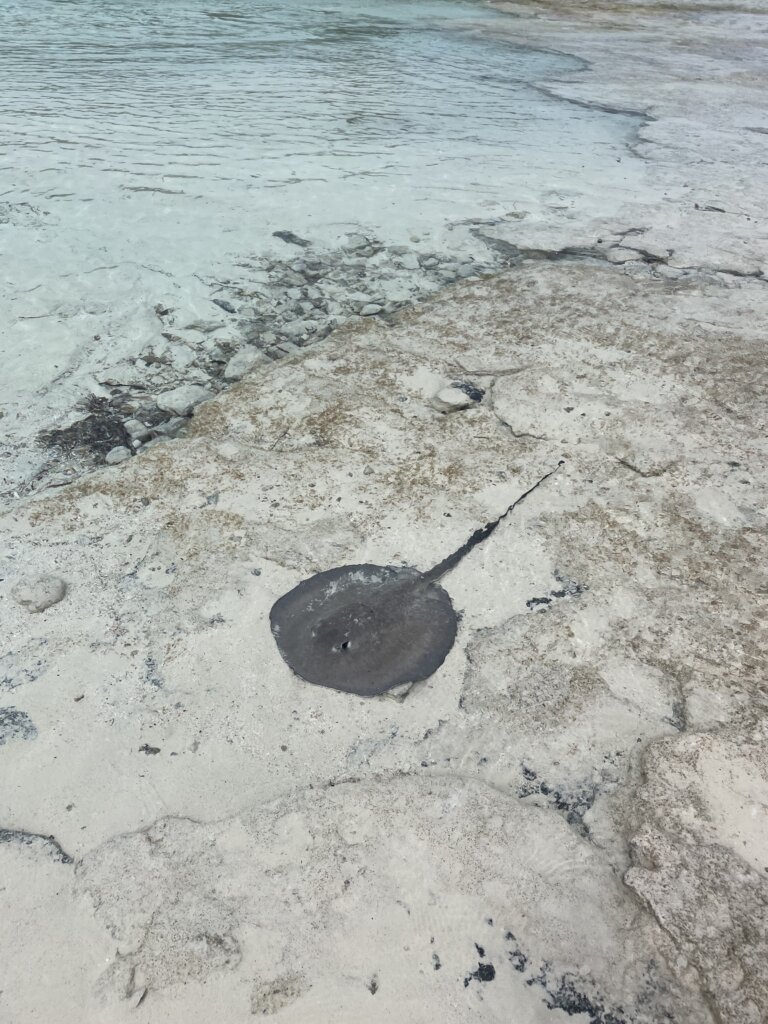
From this spot you are really close to the aquarium snorkeling spot. There are so many fish here and the coral was really pretty! It was one of the best, if not the best, snorkeling spot we visited! Around the corner from the aquarium you can hang out on the sand bars. The huge area of shallow water is stunning and we saw several sting rays as we wandering around the shore.
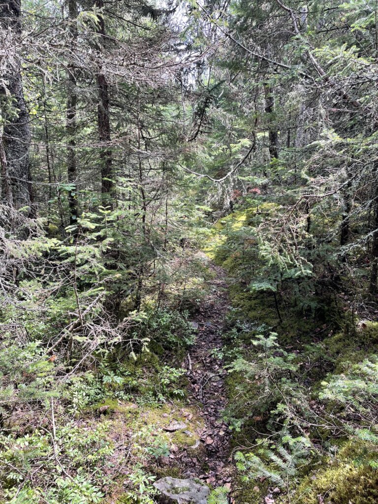
We also took the dinghy to nearby Cambridge Cay for some hiking. We really enjoyed the rocky coastline on the sound side of the island. The trail is well-marked and you can get great views along the way.
Wardrick Wells
Our final stop in the Exumas was Wardrick Wells. The north mooring field is a really pretty spot! You do need to call the day before to get on the list. We were a bit confused by this process. We called and they said there were 9 boats ahead of us on the list for arrival the following day. They didn’t confirm that we would get a ball or not. We were told to hail the park ranger on VHF channel 9 upon arrival to the entrance. When we did that the ranger asked if we were on the list, we said yes and were given a ball assignment. The ball cost us $30 for the night with a 39 ft boatl. If you can’t get into the north mooring field there is another one, Emerald Rock that typically has balls available.
There are several beautiful hiking trails on the island. After hiking for a few hours we stopped off at the coral garden at the south end of the mooring field. There is a pretty strong current if you don’t go at slack tide. We saw a spotted eagle ray and several large fish. We didn’t snorkel for long as it was pretty wavey when we went.
Wardrick Wells was another one of our favorite stops. We ended up only staying one day as we had a great weather window to sail back north from the Exumas the following day. There are plenty of other anchorages and great things to see and do in the Exumas. We hope to cruise through this island chain again some day!
While cruising the Bahamas we really enjoyed our time on Eleuthera. We found plenty to explore and wonderfully protected anchorages.
Spanish Wells
We started our time here just north of Eleuthera Island in Spanish Wells. The town of Spanish Wells has a nicely stocked grocery store- Food Fair where we stocked up on fresh food before continuing our journey through the Bahamas.
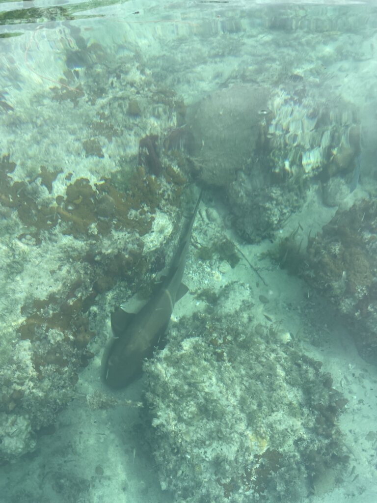
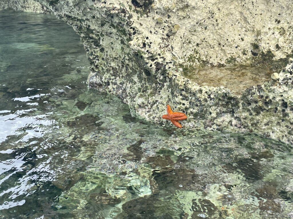
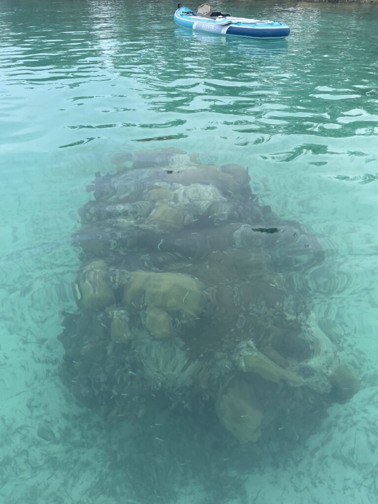
We spent four nights in the Spanish Wells area, anchored at Meeks Patch which is about two miles from town. The anchorage is nicely protected with space on the east and west side allowing cruisers to move if needed due to weather. While there are no large reefs we found plenty of small coral heads with plenty of small fish around the rocky coast of the island. There are nice beaches around the anchorage as well. On a flat calm day, we paddle boarded around the entire Meeks Patch island. We saw a lemon shark, a couple rays, turtles, fish and starfish along the way.
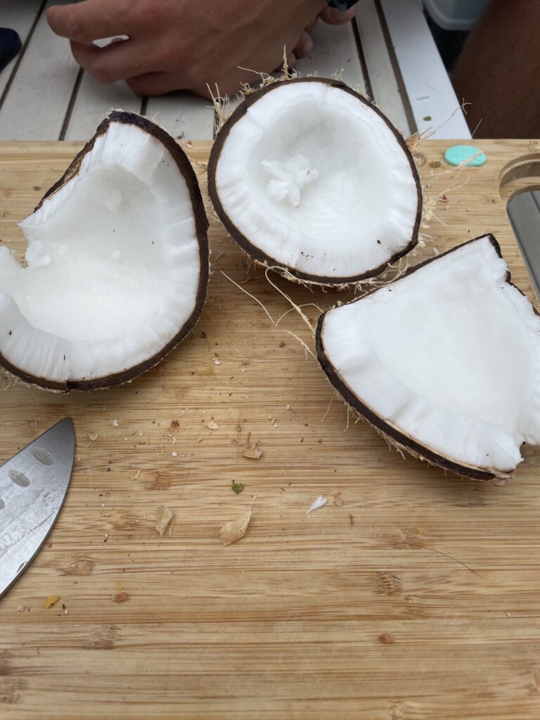
There are plenty of coconut palms on the island and we even found a large table with a cutting board type top to harvest our coconuts on the beach before heading back to the boat. The island also features roosters, chickens and pigs. We saw a couple small tour boats around the pigs with people feeding them in the shallow waters near the beach.
From Spanish Wells we headed through Current Cut south to Eleuthera. The current through the cut can reach 6-8 knots. The current is closest to slack and hour and a half after high water at Nassau. You do need to time your passage through the cut. We chose a calm day to motor through.
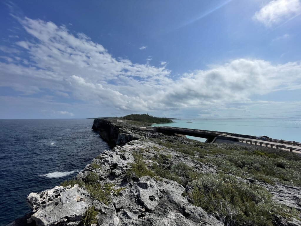
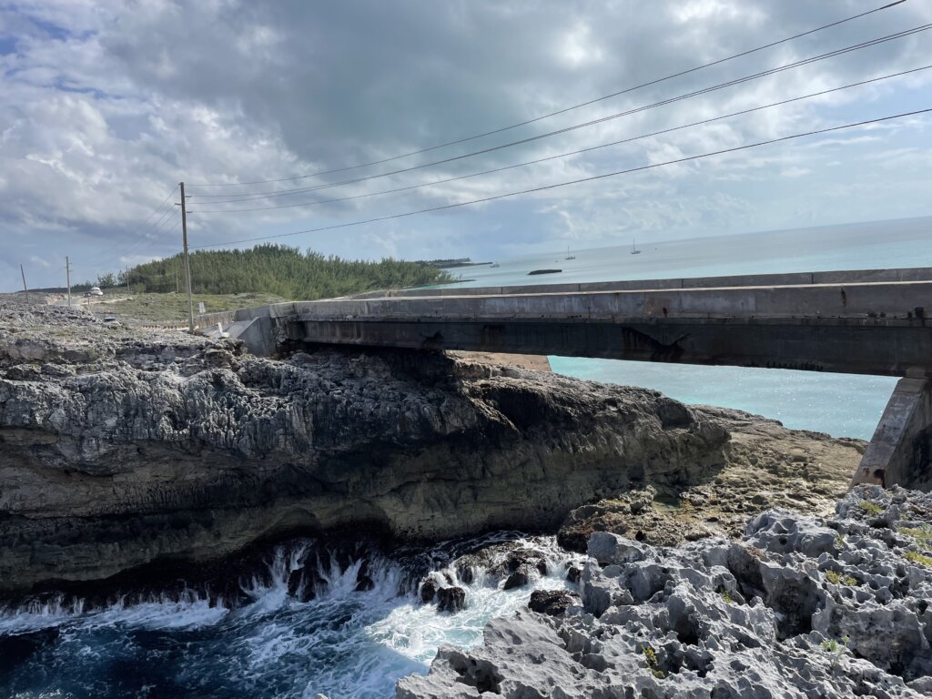
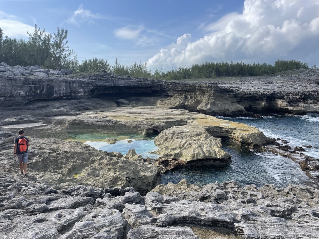
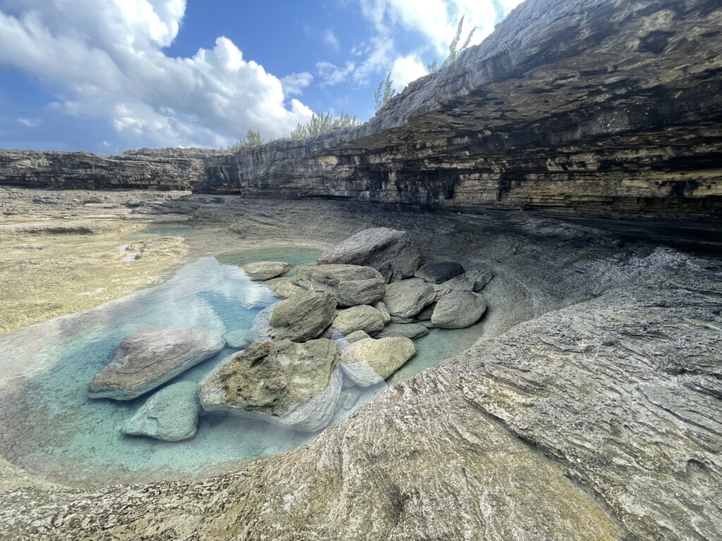
Goulding Cay
We anchored here to visit the Glass Window Bridge and the Queen’s Baths. This anchorage is really pretty and so quiet. Both the bridge and the baths were stunning and we highly recommend stopping here. You can beach the dinghy and then it’s just a short walk to both of these spots. The baths are best when visited at low tide.
Hatchet Bay
This anchorage was a land locked lake that now has a man-made, narrow channel to enter. It is a very protected anchorage. The town, Alice Town is quite small. We stopped in at The Front Porch for a drink. We had planned to get lunch but we found the prices to be much higher than we expected so after a drink we headed back to the boat to eat. From the restaurant you get great views of the anchorage and the people working the restaurant were super friendly.
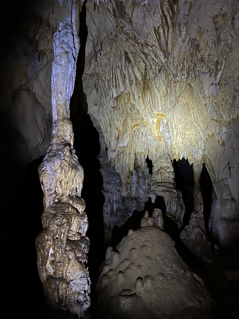
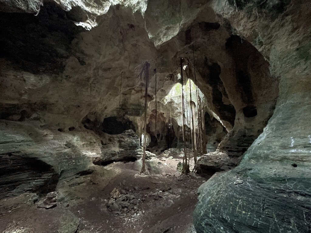
While in Hatchet Bay we walked across the island to the beach on the Atlantic side. Its a pretty beach worth a visit. We also walked to the Hatchet Bay Caves. This was a long walk, about two miles down the Queen’s Highway. The road can get busy and there is no side walk. Several times we stepped off into the bushes along the side of the road to let cars pass. The cave is really cool to see. You can walk back quite far, about half a mile is what we read. There is a small latter that you walk down and then the cave really opens up. There is a string/rope on the floor so you can follow that along the cave and then back out again. We only saw a couple bats. There is a lot of graffiti which does take away from it a bit, we hoped it would lessen the further back into the cave we went but there is plenty of graffiti throughout the entire cave. Bring your flashlight if you plan to visit.
Governor’s Harbor
On our way back north we stopped at Governor’s Harbor for a few days. We had read that the holding isn’t great but we found decent holding in shelly sand. There are old moorings and rocky patches on the bottom so it helps to have good visibility to see where you drop anchor. We really enjoyed our time here. The town is set up very well with groceries, a well stocked wine/liquor store, trash disposal, free water and a gas station very close to shore. There are a few places to tie your dinghy or beach it. Wandering around town we found several cute little cafes and an ice cream shop!
The thing to do here is the Fish Fry event on Friday nights. The small beach side restaurant serves fish, chicken or pork dinners. The bar is open and they block off part of the street for dancing. It was definitely 95% cruisers and tourists, no many locals but a very fun event!
Palmetto Point
We stayed one night in this anchorage on our way down the island. Its really pretty again with the rocky coastline. We tried to do some spearfishing but we were not successful. There are a couple small islands nearby that we took the dinghy around to explore. It was a nice, quiet place to spend an afternoon/night.
Rock Sound
Our final stop on Eleuthera was Rock Sound at the bottom of the island. The anchorage here is also super protected from most wind directions. In town you can find gas, diesel, laundry and groceries. We found the grocery store here to have better prices on fresh food than what we saw in Spanish Wells.
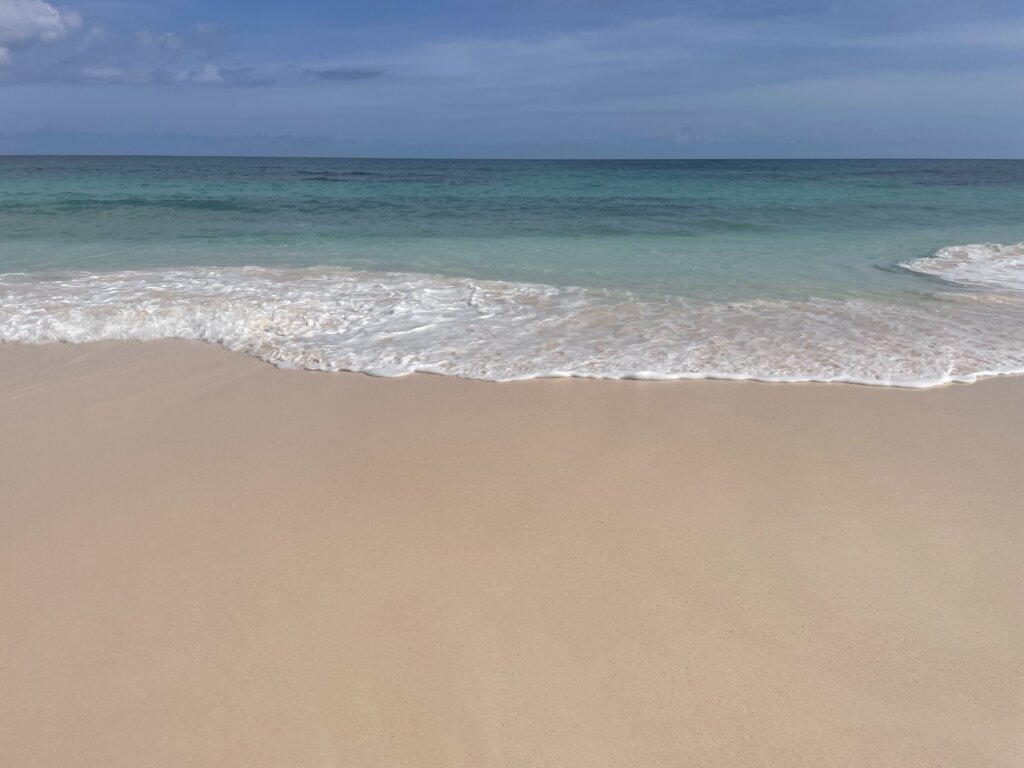
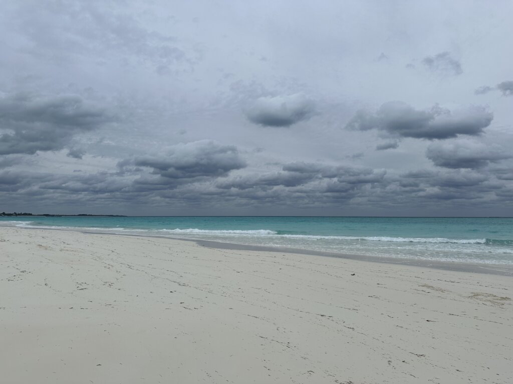
The people in town were once again very friendly and willing to help in any way they could. We enjoyed talking to a few locals on our way across the island to the beach. The beach on the Atlantic side is a beautiful, pink sand beach. While the pictures don’t really make the sand appear pink it was definitely pink when you see it in person. The sand is super soft, we found it to be one of the best beaches we had visited so far in the Bahamas.
Across the bay from town, we found a great spot for spearfishing. We got a couple snappers and a huge crab with nobody else around fishing or snorkeling.
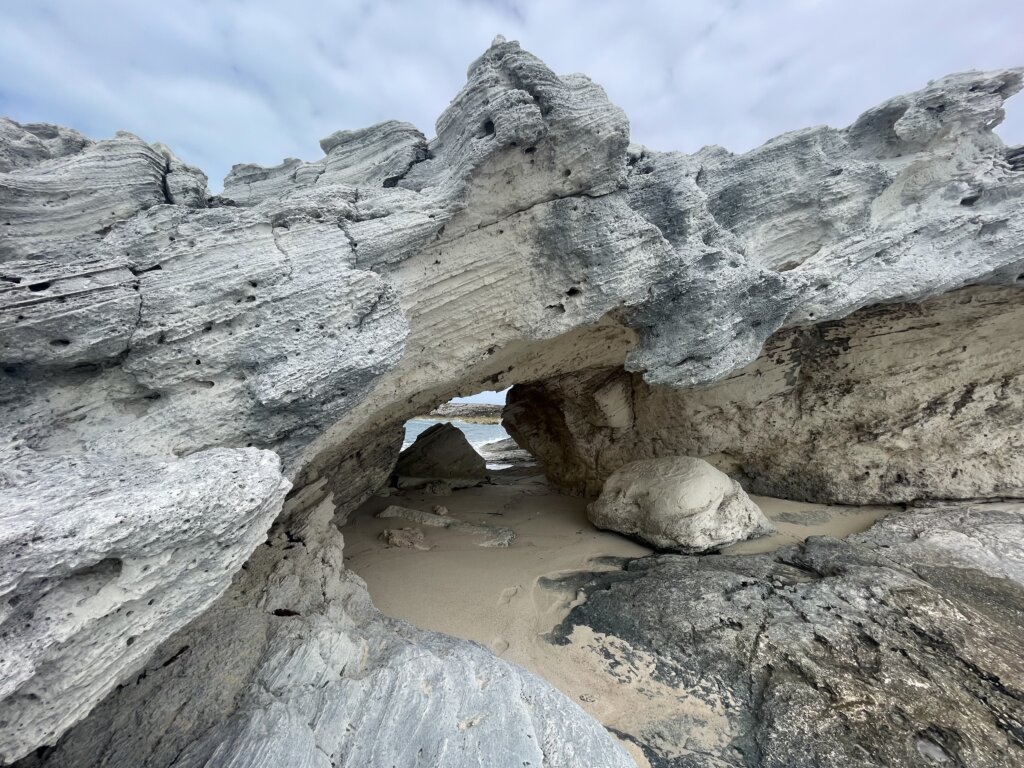
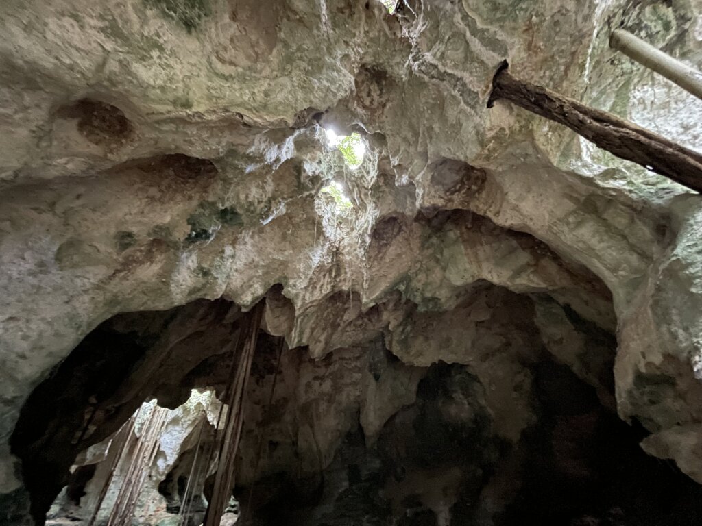
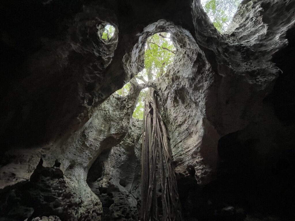
A short walk from town you can visit the Boiling Hole and Cathedral Cave. The boiling hole was not super clear, blue water but just beyond that you will enter Cathedral Cave which we thought was really impressive. Our first time through we missed about half the cave. After talking with a local artist we learned you can crawl through a small hole and continue into three more very impressive “chambers” of the cave which open up. The holes on the top of the cave have tree roots coming through them and into the ground, the sun coming through makes it really pretty in the cave. Again we only saw a couple bats flying around in the cave. We would recommend wearing shoes not sandals if planning to explore through the entire cave.
Also in town you can visit the Ocean Hole. It has plenty of fish, the water isn’t super clear but it is right in town and worth a quick stop. Before leaving Rock Sound we decided to check out the local food cart for lunch after running our final errands. We didn’t take any pictures of the food but it was really good! We had fried conch and mutton curry, both were amazing and the portions were huge. The prices here we much better than the front porch restaurant we saw in Hatchet Bay. There is no signage but if she is open and you walk up to the cart she will let you know what she has for the day.
From Eleuthera we headed off to the Exumas to continue our Bahamas Adventure! There are several other anchorages on Eleuthera that looked nice and worth a visit! Perhaps we may have to come back through someday!
After checking in at Bimini we set off for the Berry Islands. About 80 miles east, across the Bahamas Bank lays this very small island chain.
You can sail straight from the U.S to the Berry Islands and check-in at Great Harbour Cay or Chub Cay if you chose.
Great Harbour Cay
This is the most northern island in the chain. We anchored on the outside at the Beach Club anchorage which is on the north east corner of the island. This anchorage does get some swell from the open ocean so it wasn’t the most comfortable anchorage. We used a swell bridle to keep the boat pointed into the swell vs into the wind and that did help quite a bit. If you anchor along the northern shore you will be much better off than in the southern half of the bay where the swell is worse.
The beach here is stunning and quite long. The sand is super fine, soft and white. The beach is lined with houses which all were pretty empty when we visited. The Beach Club restaurant is located in the bay, we didn’t eat here but it looked nice.
On the south end of the anchorage you will find Shark Creek which is a mangrove lined saltwater creek that actually runs all the way through to the other side of the island. You can explore by dinghy or by kayak or paddle board. It was recommended to us to go on an incoming tide so that the water is more clear. We saw a ton of sea turtles and several eagle rays. We had read that there are plenty of small sharks but we didn’t see any during our visit. It is really pretty and we would highly recommend visiting while in the area.
Petit Cay lays across the bay. We headed over, unsure what we would find. We beached the dinghy and had a really nice walk along the beach and rocks, we were almost able to walk around the whole island before the beach and rocks turned into more thick vegetation and we had to turn around. We would recommend wearing some type of shoe here as the rocks are quite sharp.
Along the southern shore of Petit Cay there is a nice, shallow cove we good snorkeling and spearfishing. We got a huge lobster here. Some other cruisers who were also spearfishing the area said they saw some really nice, large fish in the deeper water just outside the rocks that line the cove. The shallow waters had some really nice, small reefs and plenty of small fish to see.
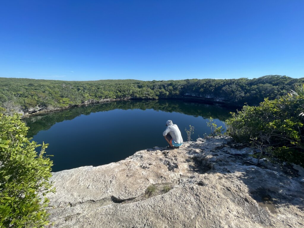
Hoffman’s Cay
Our next stop was Hoffman’s Cay. We anchored near White Cay, trying to tuck behind some land for shelter from an incoming northeast wind. During the day with this wind we got some waves which we expected but our wind died off in the evening then shifted out of the east. We spent several nights here since there is so much to explore!
Hoffman’s Blue Hole is the main attraction here. Its a short walk from beach to the blue hole, the path is very narrow but easy to find. The water in the hole is 600 ft deep and is said to have only oysters living in its waters. You can get a great view from on top of the rocks then follow the path to the right to head down under the rocks where you will find yourself right on the shore of the blue hole. The water is super clear and perfect for jumping in if you chose.
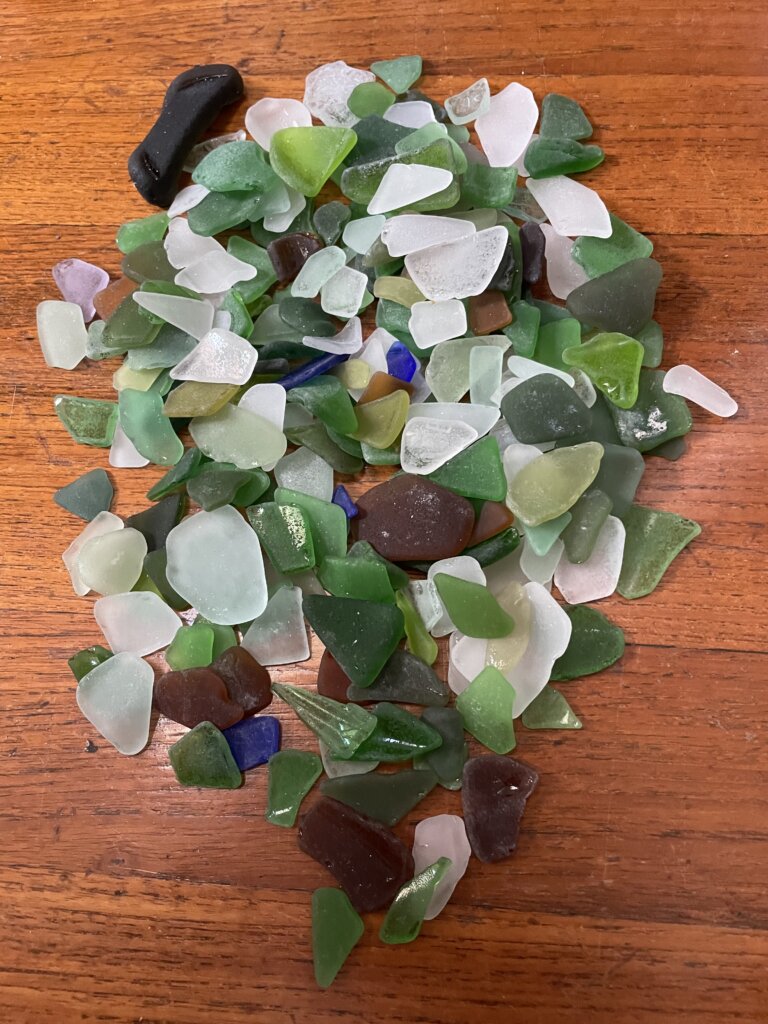
Also on Hoffman’s Cay there is a nice hike across the island on the north end of the island. Again the path is narrow but easy to find from the beach. Once across on the ocean side of the island the beach is beautiful and full of sea glass! We ended up with quite a pile of it after just a short walk along the shore.
If you head south from Hoffman’s you can explore Devil’s Cay. There is a cruisers beach on the south side of the island with a couple beach chairs, a welcome sign and small table. The chairs are not in the best shape but we enjoyed lounging in them for a bit, soaking up the sun. From that beach you can walk along the rocks around the inlet and out to the ocean side of the island. Again the beach was beautiful and full of more sea glass!
While some of the beaches around the anchorages here are private most are not and there are tons of little beaches to explore! The snorkeling in all the small bays in the area is said to be great as well. We didn’t have the warmest days during our visit so most of our exploration was on land.
This area was by far our favorite part of the Berry Islands. We could have easily spent more time in the anchorages here but the weather was changing and we had to get moving!
Frazer’s Hog Cay
We set off, south along the island chain and spent the night at Frazer Hog Cay. The beaches here looked nice but we only stayed one night before continuing on. We needed to find better protection from some incoming wind.
Chub Cay
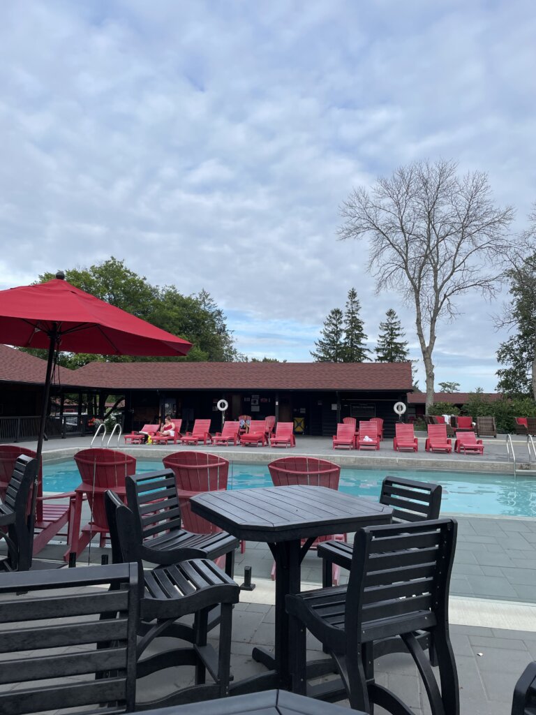
Chub Cay is the last, furthest south island in the Berry chain. Chub Cay is private but you can anchor outside in the bay. Going ashore you will need to pay a landing fee at the marina. We booked a slip for one night at the Chub Cay Marina. Booking through their website you can get a good deal. Prices fluctuate frequently. You can check the website several times a day and see different prices each time, if you do want to stay, book the slip when you see a good price. Your slip will get you access to the island and all of its amenities which include a pool overlooking the beach with swim up tiki bar, hot tub, restaurants, bathroom/showers and access to a small store with some grocery essentials.
We really enjoyed our stay here. We met plenty of other cruisers and had a nice dinner at the Nauti Rooster restaurant.
Fishing in the Berry Islands
We found the fishing all along the island chain to be fantastic! We fished whenever we were sailing, except near Chub were there is a reserve that you cannot fish. While in the Berries we caught a king mackerel, three blue runners, one cotton mouth jack, one barracuda (which we threw back), one yellow-tail snapper (we threw back because it was pretty small) and one banded rudderfish. While the king mackerel was by far our favorite, the others were really good as well!
One final note on the Berry Islands- There are really no all weather anchorages. Most anchorages are protected from 1-2 directions. If you have a lot of changing wind direction and weather it will be challenging to find protection. Anchorages with exposure to the ocean we found to be very rolly even when the wind wasn’t that heavy. Inside the island chain you don’t get swell but your exposed to west wind and often to north and south as well. We would certainly have enjoyed these islands even more if we had more settled weather.
From the Berries we will continue through the Bahamas, heading towards Eleuthera and then the Exumas. There are plenty of other anchorages in the Berry Islands that we didn’t explore this time around and we’d love to go back one day!
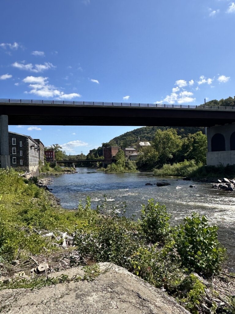
TheAtlantic Intracoastal Waterway extends more than 1,100 miles from Norfolk, VA to Key West, FL. Some lengths consist of natural inlets, salt-water rivers, bays, and sounds; others are man-made canals. Boaters on their journey south may choose to stay inside the ICW the entire trip or go outside into the open ocean. We chose to do a combination as we headed down to Florida where we staged for our jump across to the Bahamas.
Virginia
Mile 0 of the ICW is in Norfolk, VA. We actually anchored in Hampton and woke up early to head across the bay into Norfolk and begin the ICW. Norfolk also has anchorages and marinas, but we didn’t stop in the city at all this trip. The anchorage in Hampton has a free dinghy dock and there is a grocery store within walking distance which is why we chose to stay there.
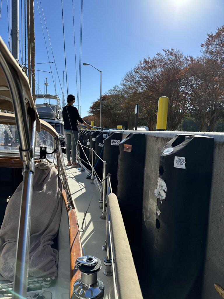
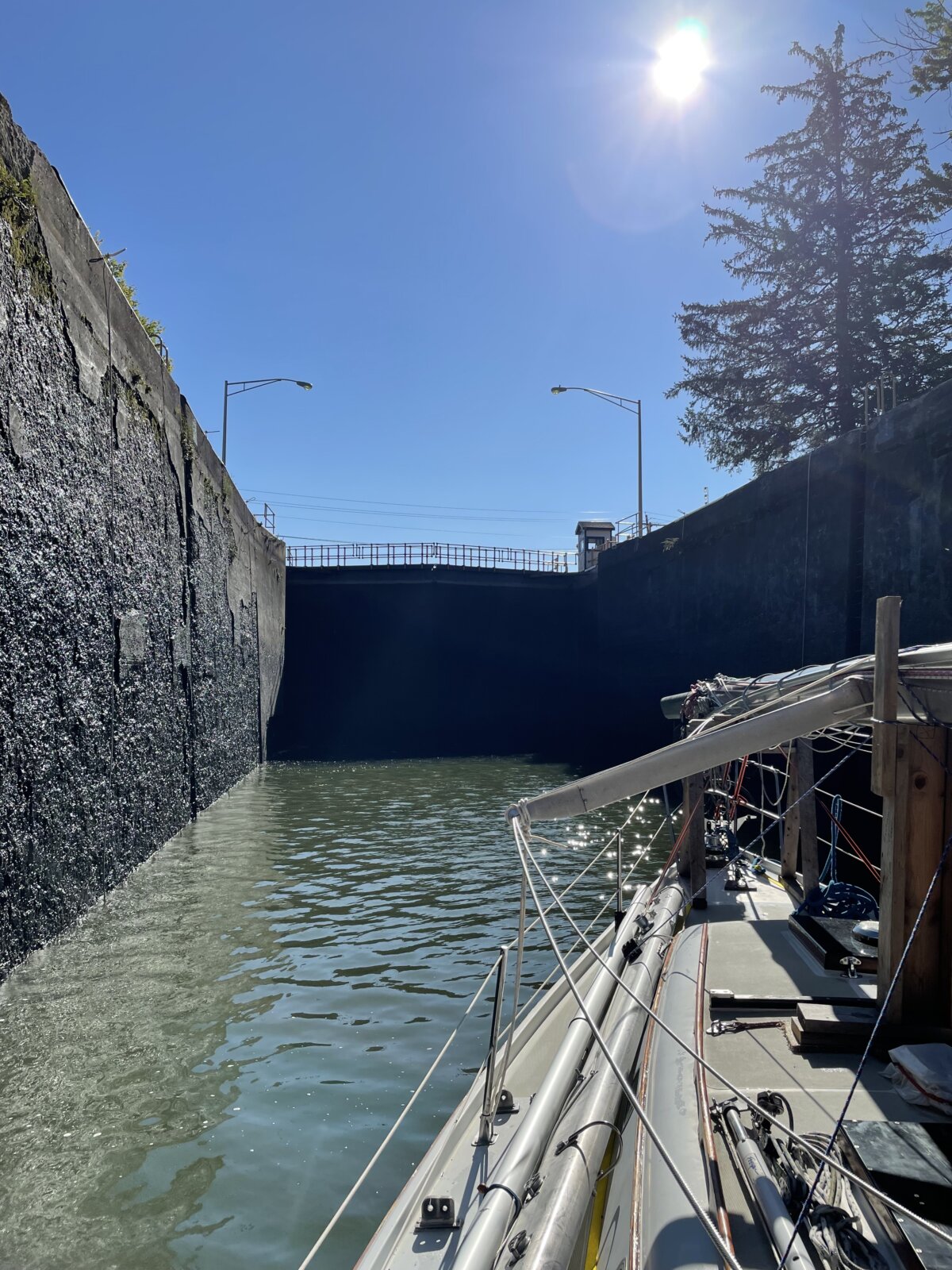
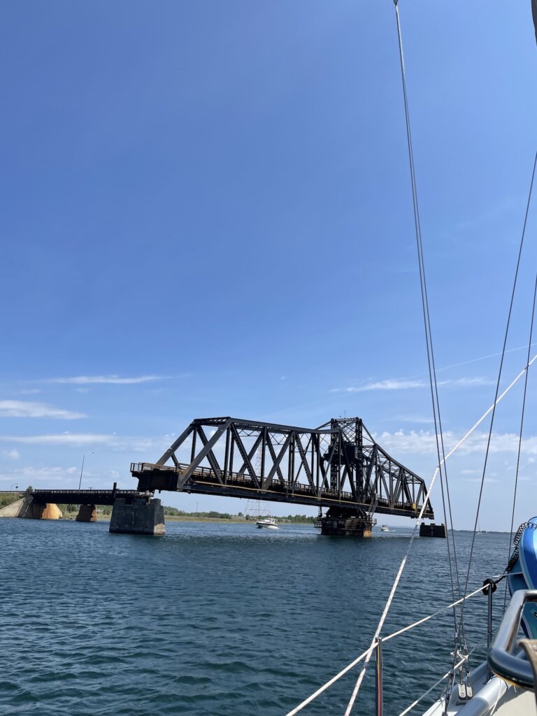
You have two choices heading through Virginia on the ICW- the Dismal Swamp route or the Virginia Cut. We chose the Virginia Cut. We draw 6ft in our sailboat and had heard that the Dismal Swamp can be too shallow in areas. The Virginia Cut does include one lock- The Great Bridge Lock. This lock raises/lowers 2-3 ft with the tide, when we went through it didn’t feel like we moved at all. The lock is quite large and can be very busy. We locked through with 15 other boats. The lock coordinates with a bridge that needs to open right after you’ve locked through. We got lucky and we were the last boat into the lock before it closed. Several boats right behind us had to wait for the next lock opening, meaning keeping the boat still in the canal for about 40 minutes. The lock opens once an hour for about 20 minutes to fill up with boats.
Along this stretch of the ICW, there are not a lot of places to stop and anchor. We ended up doing a very long day to make it to our anchorage at Buck Island. It took us about 12 hours to complete the journey from Hampton to Buck Island. A popular spot to stop before Buck Island is Coinjock Marina. This place was packed when we passed by. Boats were 2-3 deep on the end walls.
North Carolina
The next day we did another long day, we headed through the Aligator River Pungo River Canal and anchored in the Pungo River just past the Canal.
The following day we finally arrived in an actual town where we could get off the boat and explore. We landed in Belhaven, NC. Everyone in this small town was super friendly! The Belhaven Marina charges $5 to fill your water tanks. In town, there is a free town dock. We think you can stay overnight, we saw a couple of sailboats tied up there. We assume this is just first come, first serve. The dinghy dock is free right in town and there’s a place to fill water jerry cans. The grocery store is a bit of a walk but we got picked up on the way back by a kind local in a golf cart. Back at the dinghy dock we were greeted by another local woman and given a welcome packet with a bunch of information and coupons for the local ice cream shop. The town is very small but so welcoming to cruisers, we loved it! The anchorage is just in front of the marina and town, a short dinghy ride in.
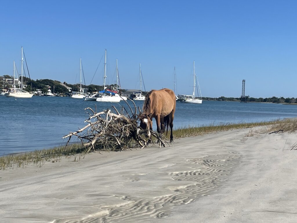
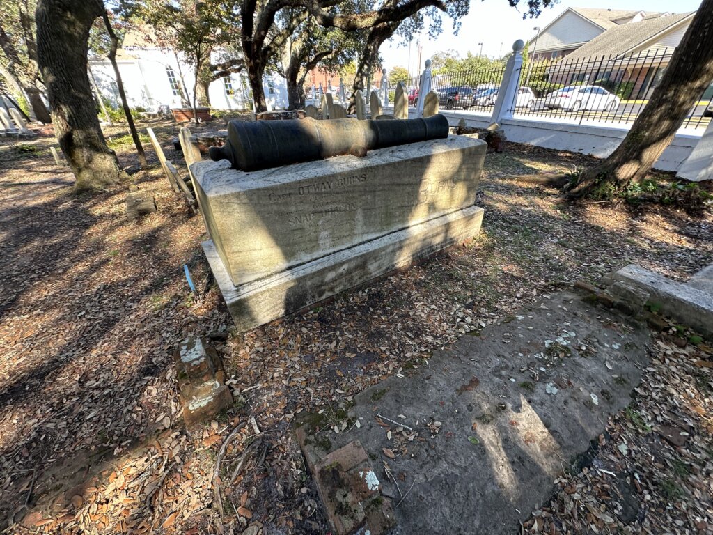
Our next stop was Beaufort NC. This is a popular stop and can be a busy anchorage. It was pretty packed when we arrived but we managed to find a spot. The anchorage is in between the town and the Rachel Carson Reserve. You can see the wild horses of the Rachel Carson Reserve roaming the beach. The Reserve has a nice beach and a couple of trails for hiking/walking. We really enjoyed visiting, it is completely free to visit. The town itself is really quaint and nice to walk around. The Maritime Museum is free and well worth a visit. There is much information about the area, fishing, boat building, surfing, and the history of Blackbeard and pirates along the coast. We also walked through the Old Burying Ground which is beautiful to walk through. You will see old tombstones, some dating back to the 18th century. At the entrance, you can pick up a guide which will provide additional information about some of the specific graves on the grounds.
The current in this anchorage is quite strong. We were in Beaufort for several days, waiting out a pretty big blow. With how crowded the anchorage was several boats ended up pretty close together with the current and wind. The monohulls were more affected by the current and would swing at a much different rate than the catamarans. Several boats around us were on deck with the engines on, pushing off each other for a few hours during the afternoon. We were spaced well with our neighbors and had no issues but it is something to be aware of.
From Beaufort NC many people chose to jump outside to Wrightsville Beach. We were going to do this passage outside but the weather wasn’t cooperating and we were on a schedule to meet up with some friends. Given this, we headed off inside, along the ICW. Our next anchorage was at Mile Hammock Bay which is near Camp Lejune. There can be lots of military activity here, the military owns the land around the anchorage and you are not allowed on shore here. The ICW can at times be closed if they are doing active shooting practice. We did not encounter this. Along the way, you will see signs on the ICW that say, when flashing you cannot go through and must anchor until active shooting practice is completed. We tried to look online for a schedule before we left for the day but didn’t find anything that would tell you ahead of time if they were planning on shooting practice that day. Other than helicopters circling overhead in the evening we had a quiet night in the anchorage.
Our next stop was Carolina Beach. You can anchor here but we chose to pick up a mooring ball. There is a large mooring field with well-maintained mooring balls, $30 a night. You need to reserve on dockwa. There are no marina amenities included with this mooring field. We were visiting friends in the area so it was nice to know the boat was safe while we were gone. From the mooring field, you can dinghy to the kayak and dinghy dock and tie up for free. A very short walk from the dinghy dock you will find Northend Minimart Cafe which has really good breakfast burritos!
From Carolina Beach, we chose to jump outside in the ocean for an overnight passage to Charleston. We exited at the Cape Fear which is a wide channel, easy to navigate. Charleston is also a Class A inlet which was easy to navigate the following morning.
South Carolina
Charleston is a place we have visited before but never by boat. We love the city however the anchorages were very rolly. One anchorage is fouled and per reviews on everything we read the local divers are out nearly every day recovering anchors. We anchored away from the fouled area, further out into the bay. There is a free dinghy dock on the south side of town, it is in the marina so we felt super safe leaving the dinghy there all day. The anchorage near the Yorktown ship, on the north side of town also has a dinghy dock but that one has a $5 charge per day. We were told by some friends who anchored over there that it is also rolly but maybe a bit better than on the south side of town.
The other issue we had with Charleston’s anchorages was that there were a lot of derelict boats. Most of them are congregated together away from where most cruising boats anchor but we did have one that was next to us. While it wasn’t an issue while we were there we didn’t feel this anchorage was somewhere we would want to be in bad weather. With some stronger winds forecast we decided to continue down the ICW and find a calmer anchorage vs wait in Charleston for a weather window to head south out in the ocean.
An important note is that the tides and currents get progressively larger from here on out, until they peak in Georgia. When continuing down the ICW you want to leave Charleston with the current going in the direction you are going. You will go through Elliott Cut not long after leaving town and the current can move very quickly through this cut.
In this stretch, we did a couple of shorter days. Not moving too far we anchored at Church Creek for the night which is just off the ICW. It was very calm and quiet which is exactly what we were looking for!
The following day we headed to South Fenwick Island. With the tides being larger we factored that into when we left as we wanted to get to Watts Cut at high tide. We made it through without any issues but the water can be shallow in this cut. (we draw 6 ft)
There are a couple of anchorages near South Fenwick Island. It is very pretty back in this section of the ICW. On South Fenwick Island there is a free dock and from there you can walk the island trails. Bring bug spray, we encountered a lot of mosquitos! The Island has a lot of history which you can read about as you walk the trails. It belonged to a freed slave and his family for a time. The trails are nice and we were the only ones there when we visited. A must-do when anchored here is to go to B and B Seafood. This is not a restaurant, they are a seafood company that sells their freshly caught shrimp. They had several types of fish, oysters, and lobster as well but the main attraction here is the shrimp! The place is no frills, just seems to be lost in time. The people are super friendly and you can’t beat the price at $8 lb.
Our next stop was Beaufort SC. In this section of the ICW, we navigated through the Ashepoo Coosaw Cutoff, and again we planned to go through at high tide. We had no issues and made it to Beaufort where we anchored just behind the mooring field. In Beaufort, there is a free dinghy dock right in town. There is a grocery store but it is about 2 miles away. We loaded up and took an Uber back to the boat. We really enjoyed wandering the neighborhoods close to town. There are several historical homes and many, many antebellum homes to admire. We also were excited to walk part of the Spanish Moss trail. The trail is nice, paved, and wide so there is plenty of room for walkers and bikers. We were expecting it to be prettier but it was still nice to walk. The prettiest parts of town, with trees that are dripping with Spanish Moss are found just walking around the neighborhoods. There are also several old churches which are pretty to see around town. We enjoyed our time in town even though the weather wasn’t great.
Georgia
Again, from Beaufort, we were hoping to be able to jump outside but the weather was still not in our favor and wasn’t going to be for some time. So down the ICW we continued. In Georgia the tide peaks at 9 feet and with a strong current. This means most boats can get through but you may need to plan transit at high tide. We anchored near Thunderbolt Ga in Skidaway River. And the following night in Crescent Creek then at North Lanier Island our third night. All of these anchorages were calm, even in winds gusting into the 20s. There wasn’t much on land around these anchorages, they were just places to sleep before continuing on the following day. The sounds that you pass in Georgia will be choppy in higher winds but we transited past with winds gusting to 25 and found it manageable.
After several days of bad weather we made it to the end of Georgia. We anchored at Cumberland Island. Cumberland Island is part of the National Park Service. There is a dinghy dock and signs posted on the dock instructing boaters on how to pay. The fee is $15 a person and then your pass is good for a week. The signs say to keep to email receipt on your phone in case a ranger asks, we were never stopped or asked while we visited.
The island has beautiful hiking trails, beaches, and ruins of an old manor owned by the Carnegie family (the Dungeness Ruins). We saw several armadillos, turkeys, and many deer (including two albino ones). There are wild horses on the island as well but we only saw one on the beach as we were leaving the anchorage. The island was a highlight of the ICW for us and we definitely recommend visiting!
Florida
From Cumberland Island we headed across the St Mary’s inlet to Fernandina Beach Fl where we spent a few days. The dinghy dock at the marina does charge $5 a day however nobody checked and this was not enforced at all while we visited. The town is nice to walk around with plenty of good restaurants and lots of small shops. The beach is just over 2 miles but the walk was nice. There are several grocery stores but they are a couple miles away. The current in the anchorage here is quite strong. On a day when the wind picked up we had some issues with boats moving too close once the current switched. It is a busy anchorage but give yourself plenty of space if you can.
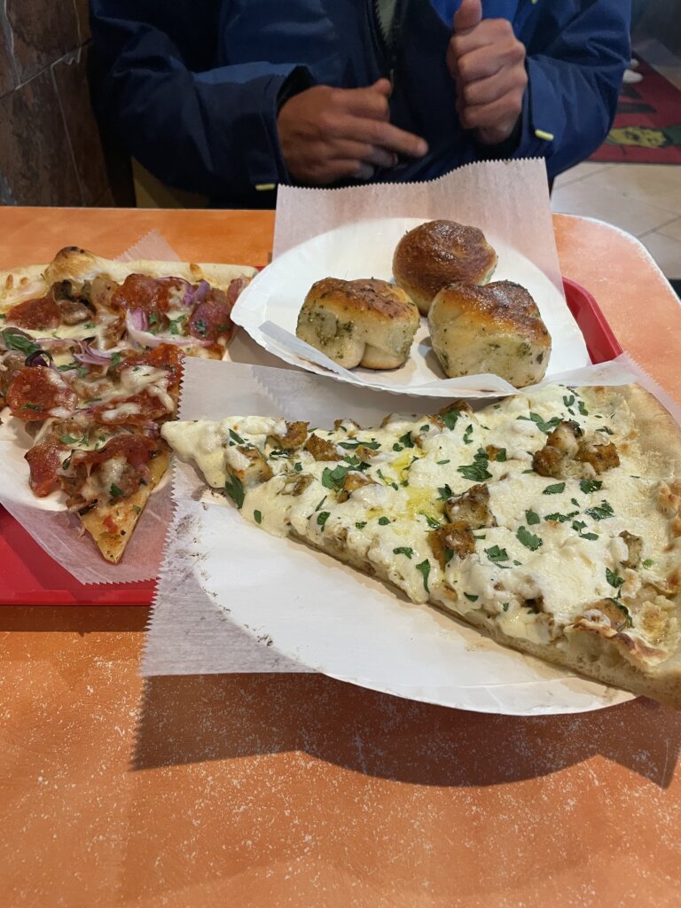
Finally, we were getting some nice weather so we could jump out into the ocean. From Fernandina Beach, we headed a short way through the ICW and went out the Jacksonville inlet. We then headed down the coast to St Augustine. Both these inlets were easy to navigate. St Augustine inlet does have shifting shoals, the bouys are moved around frequently. We found Aqua Maps and Navionics sonar charts were super accurate when we went through. The marina here does charge for use of the dinghy dock near the old town. The fee is $12.50 a day but that does get you a bathroom card for access to their showers and laundry. There are many beautiful buildings in town and the old fort is cool to walk around. It was quite busy and filled with tourists when we visited. As we wandered through town we saw a long line of people waiting outside Pizza Time which serves Brooklyn-style pizza by the slice. We gave it a try and it didn’t disappoint! After lunch, we headed to Verano Beach, where the dinghy dock is free. There is a grocery and liquor store a close walk and the beach was quite nice.
Our next outside jump was from St Augustine to the Ponce Inlet. We anchored just inside the inlet. The inlet was easy to navigate. There is a jetty and on that side of the channel we had plenty of water to navigate in. It looked like a nice area but we only stayed the night and kept moving the following day. From there we stayed in the ICW to Titusville. There is a good anchorage in Titusville however we did chose to stay in a marina here for several nights. We got a pretty good weekly rate and we hadn’t been to a marina in two months. We took advantage being at a dock and did a re-set, washing the boat inside and out, doing several projects and visiting with family. We had hoped to stay at the municipal marina however their slips were full. We ended up at Kennedy Point Yacht Club. The marina was okay. We would recommend double checking the math before paying as we were quoted a few different prices that were higher than they should have been. The owner was nice about it and willing to run the math with us on the phone. The price we actually paid was about $80 cheaper than what he originally told us. The marina is full of boats that look to have been there for a while and has an active live-aboard community. Everyone was very kind. We didn’t encounter any other transient boats while we were there. They have laundry and a mail room so it was a good place to send packages. It has everything needed except a fuel dock.
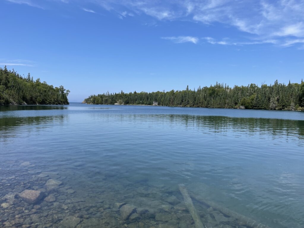
After 5 nights at the dock we were ready to head south. We left the marina and made it to Lebasso Bridge where we anchored for the night. The anchorage was right past the bridge but nicely tucked back from the ICW channel. Its a good spot to sleep and then continue on the following day. Our next stop was Fort Pierce. We anchored near the inlet. There is plenty of space on either side of the channel. The water here actually is much clearer and something we felt you could swim in. This was the first time since leaving the Great Lakes that we saw clean looking water in our anchorage!
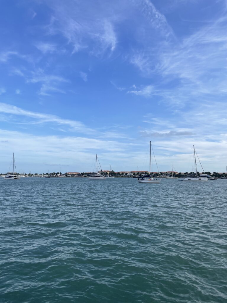
From there we jumped outside to West Palm Beach which was going to be our final stop in the U.S before crossing to the Bahamas. West Palm is a popular staging point for the Bahamas and the anchorages were busy but we found space without any issues. We could actually see the bottom here when we dropped the anchor the water is so clear! Peanut Island, near the anchorages is beautiful and in town you can find everything you need.
The town dinghy dock is free but is located on the south side of the lift bridge. We anchored closer to Peanut Island so it was a longer dinghy ride for us into town. You can anchor right near the town docks. That anchorage looked nice and less crowded.
If you are looking for diesel fuel, Pickle Rick’s Fuel Barge is a great way to go! They typically hang out south of Peanut Island. You can hail them on VHF 71 to find out their location or just head over. They are also on AIS.
After several weeks of no weather window to cross to the Bahamas we decided to continue south. First we went about 10 miles south the Lantana. The town down here is nice and the anchorage is very close to the town dock which is nice. Groceries are a short walk away as is aWest Marine if needed. The beach here isn’t very big so plan to go at low tide if you want to have a beach day.
From there, we took the inside route to Fort Lauderdale. There are a ton of bridges in that stretch! It is doable but be prepared for lots of waiting around. Its possible to time most of them well as some are every hour and half hour and others are on the quarter and three quarter hour. Our recommendation would definitely be to go on the outside after West Palm if you have the weather window to do so. The main anchorage in Fort Lauderdale, Lake Sylvia has space for quite a few boats. It was very crowded when we arrived but we thankfully managed to squeeze in.
General Tips for the ICW
Everyone said to follow Bob’s Tracks and keep up with the Facebook Group. We did not do this at all. We had a Waterway Guide Book and used their website to see depths for specific shallow areas we were concerned about. The Website was super helpful, more so than the book. We both agree we could have easily done this without buying the book.
The current changes as you move between inlets. This makes it tricky to plan how long it will take you to get to your destination. It will be with you until you get about halfway towards an inlet then it will switch and be against you. We always left with current helping us and then you get what you get as the day goes on and you move along.
Most bridges that need to open do so on the hour and half hour but we encouraged a couple that only opened at the top of the hour or at the bottom of the hour. Waiting for a bridge opening can be tricky in the current so try to time them as best you can.
People use the radio often especially to hail other boats for a “slow pass”. Sometimes we found this unnecessary if there was plenty of room for them to pass but it is always appreciated that boats slow down when passing. There are some narrow parts when it is nice to know ahead of time what side another boat is going to pass on.
It is difficult to sail most of the ICW, even in the sounds that are larger bodies of water it is often very shallow if you stray outside of the channel. Be prepared to motor or motor sail if your staying inside.
It is a long journy. We were both feeling a bit burnt out by the time we reached Florida. Alot of that was due to bad weather we encountered but still it is a long way to travel. Take your time in the places you want or the unexpected places you find and love.
Take time to talk to other cruisers. You will see the same boats over and over again along the way and it is nice to chat and compare notes with other people traveling as you are.
We entered the Chesapeake Bay via the C & D Canal. We spent several weeks in the bay waiting out hurricane season before continuing south along the Atlantic Coast. The Chesapeake Bay has much to offer and we really enjoyed our time cruising here.
We had hoped our first stop would be Chesapeake City in the C & D canal. The anchorage was quite full when we arrived and the depths were a bit shallower than we hoped. We saw 8 ft at high tide and we draw 6 ft. With all that, we continued on and made it into the Sassafras River where we anchored for our first night in the Chesapeake.
Sassafras River
We anchored about 3 miles up the river. There are plenty of places to anchor in the Sassafras, several much closer to the bay. We wanted a very quiet, protected spot after having several rolly anchorages in the nights before our arrival into the Chesapeake.
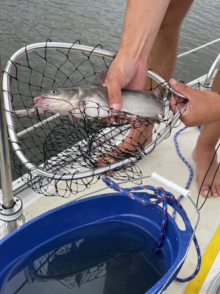
The following day we headed further into the river to anchor near Fredericktown. There isn’t much in this town, several marinas and restaurants. It was a challenge to find somewhere to land the dinghy. We made it work and met some family for lunch while we were in the area. We also had great luck fishing in the Sassafras! We caught two catfish in about 15 minutes using just some cheese we happened to have in the fridge! We fried them up and they were delicious!
Middle River
The next stop for us was Middle River. We were waiting out some high winds and rain that was forecast. We chose this location in part because friends of ours enjoyed this anchorage when they sailed through the Chesapeake the year before and also it looked like there was a grocery store nearby. We actually ended up not getting off the boat at all while we were here. It is a very cute area with little houses along the coast and several marinas. There are a few restaurants/bars if you are looking to head to shore. Once the rain cleared we took off to explore further down the bay.
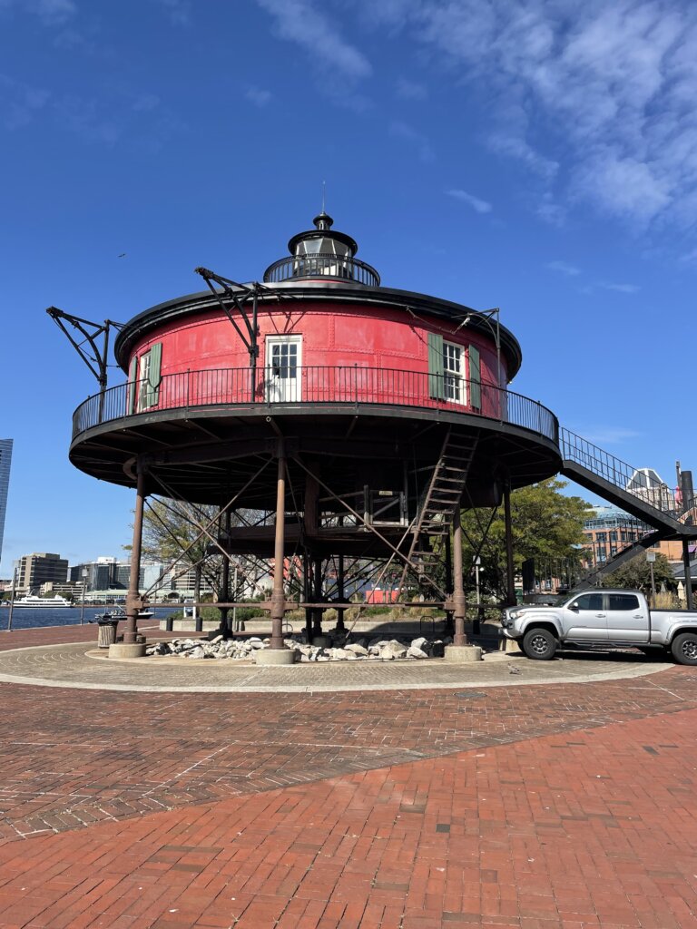
Baltimore
The anchorage here is in a perfect location! A dingy dock, grocery store, Ace Hardware, and West Marine are nearby. It is also within walking distance of the inner harbor and downtown. We really enjoyed our time in this city! It was probably the highlight of the Chesapeake for us.
From the anchorage, you can walk along the harbor, this walk will take you through the Fell’s Point neighborhood, past Little Italy, and into the Inner Harbor where there is plenty to see and do!
There are several historic ships in the harbor. You can purchase tickets and walk aboard them all.
The USS Constellation- She is a sloop-of-war. It was the last sail-only warship designed and built by the United States Navy.
The USCGC Cutter 37- She resides on Pier 5 along with the Seven Foot Knoll Lighthouse in the Inner Harbor
The LV116 Chesapeake- She resides on Pier 3 and was considered to be among the most modern ships in use with the U.S. Lighthouse Service in its time.
The USS Torsk – This is the only submarine in the Baltimore collections. She was the only submarine out of its Tench Class fleet of ten to see service during World War II.
The Seven Foot Knoll Lighthouse was built in 1856. It is one of the oldest Chesapeake lighthouses still in existence. It was closed when we walked by but it was still cool to see. It is located in the inner harbor, you can’t miss it if you are out walking around.
Once we were done walking around the harbor we needed some lunch! From Inner Harbor, it was a short walk to get to Lexington Market. It did seem like the market was not in the best part of town and there are many homeless people outside the market loitering. Once inside we felt totally fine and there were a lot of great food options to choose from! We would highly recommend eating here.
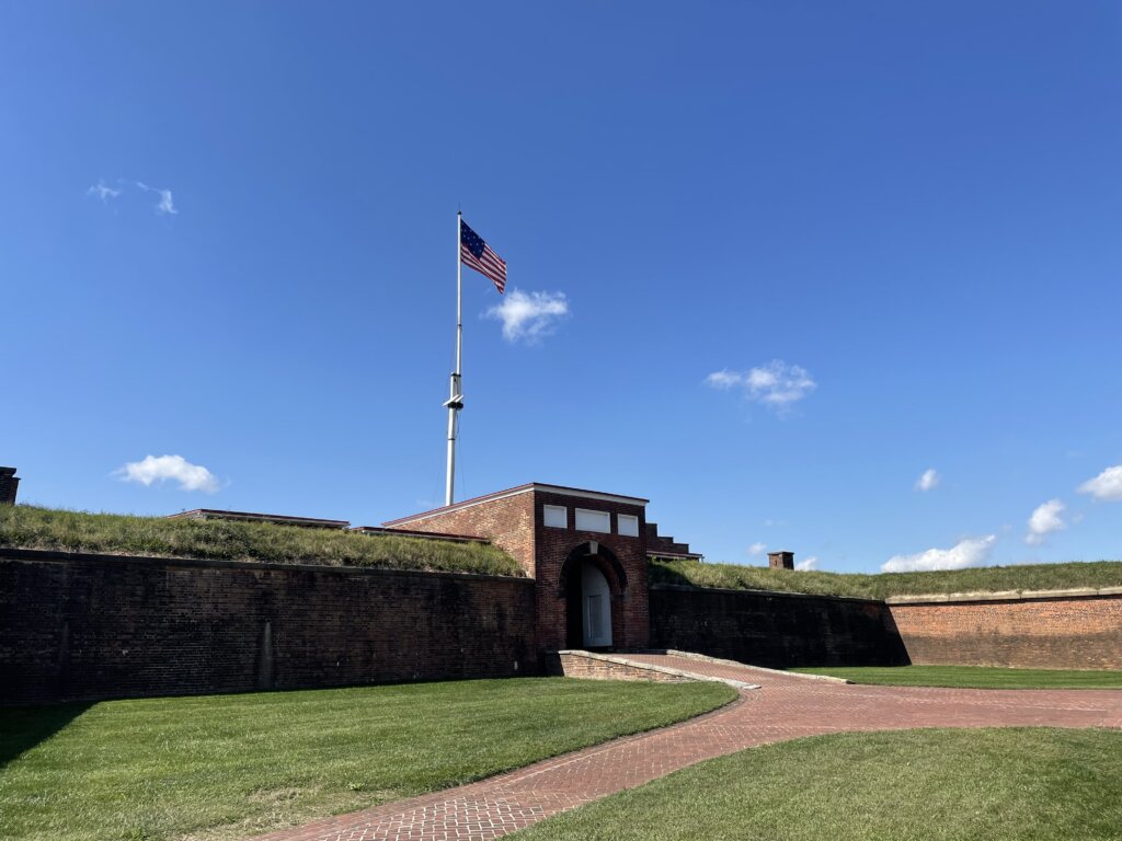
The following day we headed to Fort McHenry. The entrance fee is $15 for adults. You can walk around the grounds for free. We did enjoy walking into the fort and seeing the exhibits. The fort itself is kept up well and worth a visit.
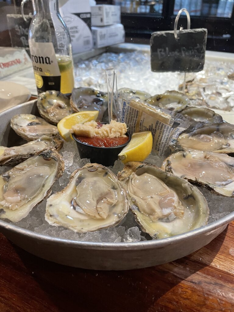
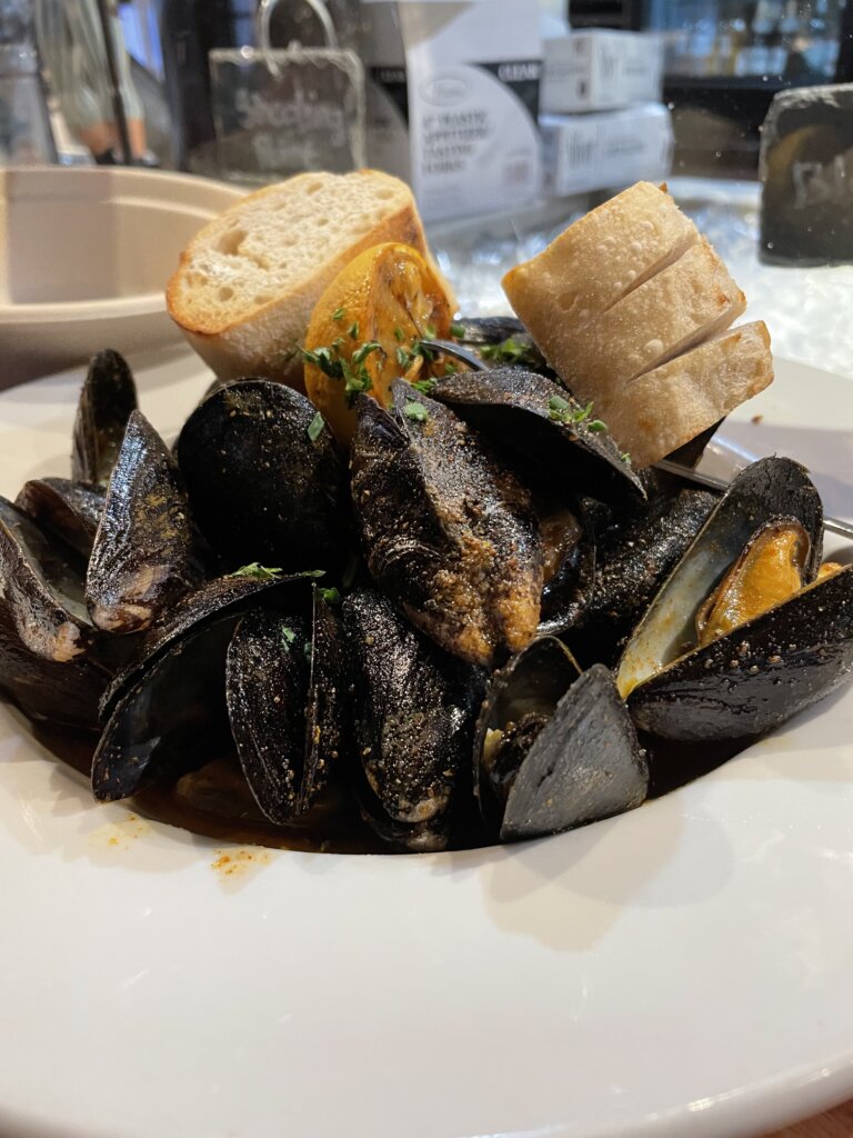
While we were in the city we made sure to take advantage of a great happy hour deal! Mamma’s on the Half Shell is very close to the anchorage and during happy hour you can get $1 local oysters as well as drink deals. We loved the fresh, raw oysters here. They also had really good steamed mussels!
Most of what we saw you can walk to from the anchorage. The fort is a bit farther away so we hopped on the Charm City Circulator from the inner harbor. This free bus system will take you to many places within the city. We used the Banner Route bus to get us to and from the fort. We found the bus to be clean, on time, and a really good way to get around.
Annapolis
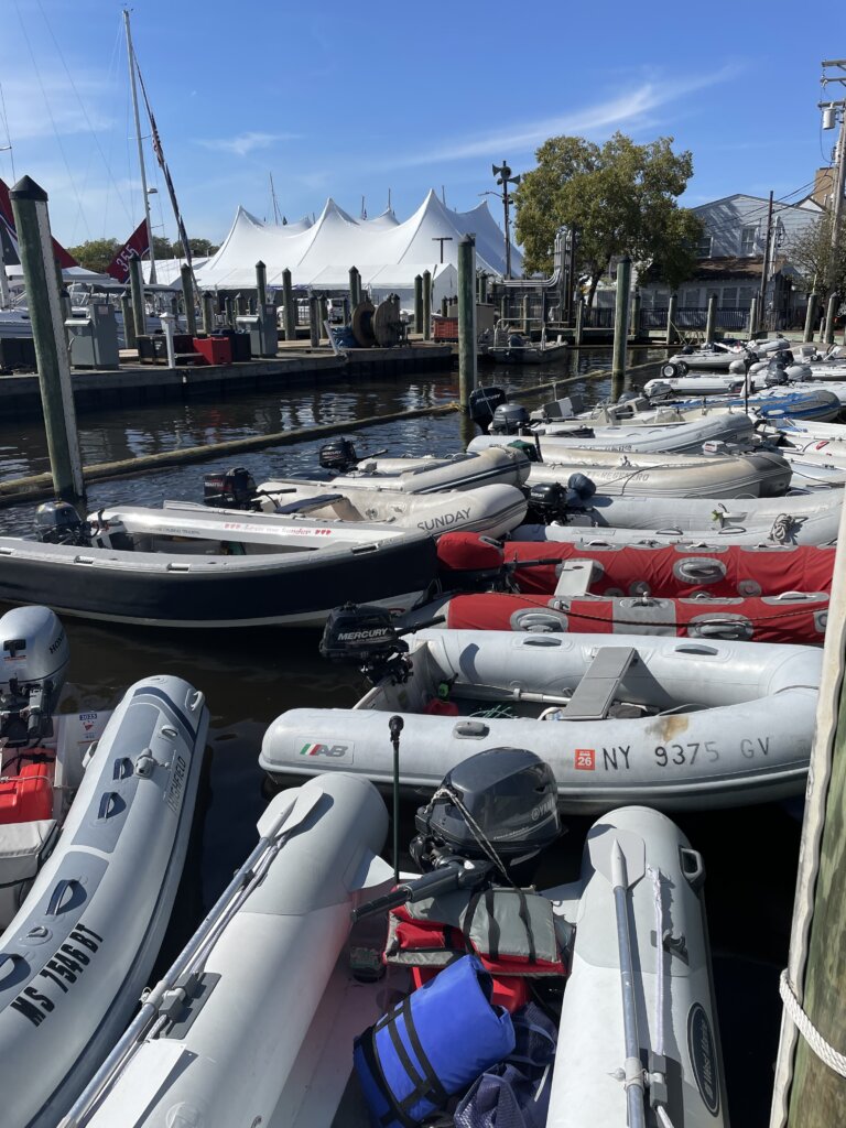
No sailing trip to the Chesapeake would be complete without a visit to Annapolis. We were heading through in the fall so we timed it to be there during the boat show. We weren’t sure how it would be finding a spot to anchor but it actually worked out well for us. We found plenty of space in the Annapolis Bay anchorage when we arrived on Wednesday. We ended up not liking how rolly it was in the bay so we headed up to Weems Creek which is about 2 miles from town. We found plenty of space in this quiet anchorage. From Weems, you can pull your dingy ashore at the Tucker Street boat launch. The city dinghy dock in town was really packed but still, we were able to tie up there as well during the boat show.
While in Annapolis every cruiser should stop at Bacon Sails and Marine Supply.. They have everything you could need! There are consignment items for cheap as well as new items. Everyone who worked there was great and we ended up staying and chatting for a while as we shopped! During the boat show they have great sales as well.
Wye Island
After several days in Annapolis for the boat show, We found a nice, quiet anchorage near Wye Island. We had hoped the hiking trails would be more accessible. We chose the Wye East G3 anchorage. It looked to us that from one bay over the trail came pretty close to shore. We headed over in the dinghy but found it difficult to find a place to land the dinghy on shore. Once we found a spot we ended up having to walk through pretty thick, prickly bushes to find the trail. We turned back after a bit and didn’t end up hiking the established trails. The island is still very pretty and we did enjoy the quiet anchorage.
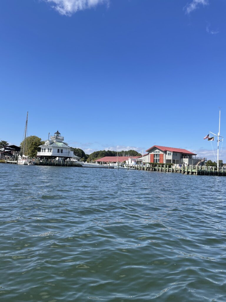
St Michaels
From Wye Island, we moved to the nearby town of St. Michaels. We had heard this was a very cute town and it did live up to the hype! There is a dingy dock in town and the town itself is very quaint. There are plenty of shops, restaurants, cafes, and ice cream places in town. We enjoyed a hot chocolate and sat outside to enjoy our afternoon after wandering through town. There is also a large marine museum here with plenty of ships you can see from the water.
Solomons Island
We stayed here for a few days, waiting out some high winds. There are plenty of places to tuck in and anchor. We were also very happy to see a free dinghy dock with a pump-out station, meaning free water! We filled several jerry cans while we were here. On the island, there are several restaurants and shops as well as a nice boardwalk along the water. We absolutely loved Cryptic Pizza. You order at the window and sit outside at picnic tables on the lawn, facing the waterfront. The pizza was amazing! Some of the best we have had! A short walk from the island is a West Marine and 7-11 convenience store. No grocery store is walkable. The was a large liquor and wine store right next to West Marine. This West Marine was much better stocked than what we experienced in Baltimore.
Deltaville
By this time, it was getting pretty cold and we were ready to head south. We jumped down to Deltaville. The channel to enter here is very narrow and it winds close to shore. It is well-marked and we made it in without any issues. We entered in daylight and in calm conditions. We had read on No Foreign Land that the Jackson Creek Marina has coin-operated laundry available for boats at the marina and anchored. We also read there was a free dinghy dock with water available. When we got to the marina we didn’t find an actual dinghy dock but there were plenty of empty docks to leave the dinghy and there was water there. We passed a sign saying the docks were for marina guests only but nobody said anything to us. The laundry also says it is for marina guests only or you can pay a fee to use the marina facilities for a day. $11 a person gets you access to laundry, bathrooms, showers, and their pool. We opted not to pay and found that all the laundry machines were in use so we headed back to the boat.
There isn’t much of a town here to walk around but the anchorage is well-protected and calm. After a day of relaxing and doing some projects, we headed on to our last stop in the Chesapeake.
Hampton
Our last stop was Hampton, at the very bottom of the bay, across from Norfolk. From the anchorage here there is a free dinghy dock and a grocery store within walking distance. We re-provisioned and relaxed for the afternoon before continuing on into the ICW the following day.
Final Thoughts on the Chesapeake
The Chesapeake Bay is a nice place to cruise. There are a ton of anchorages that are well-protected, all over the place so you are never too far from safety. We did find that a lot of the anchorages are surrounded by houses so if you do want a secluded spot you need to spend a little extra time planning to make sure you find the right spot.
One thing we weren’t prepared for is how shallow and shoaly the bay is. There are also a lot of exclusion zones/prohibited zones on the chart you need to watch for and avoid. The crab pots are everywhere! We kept seeing buoys that said “crab line” but it appears people put crab pots all over, on either side of the line. This isn’t a place where you can just set your sails and go without constant attention to the charts.
We spent most of our time in Baltimore and Annapolis, waiting to meet family for the boat show. If we had more time we would have planned to find more remote, secluded anchorages. There were also plenty more cute, little towns that we didn’t have time to visit. Maybe someday we will be back, you never know!
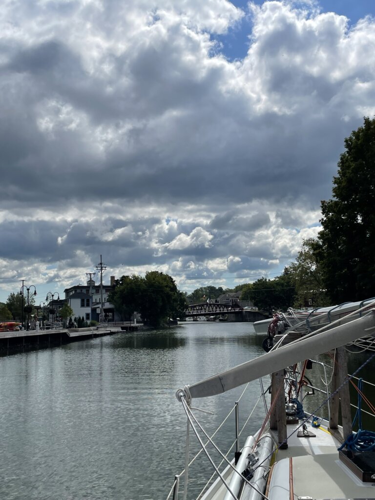
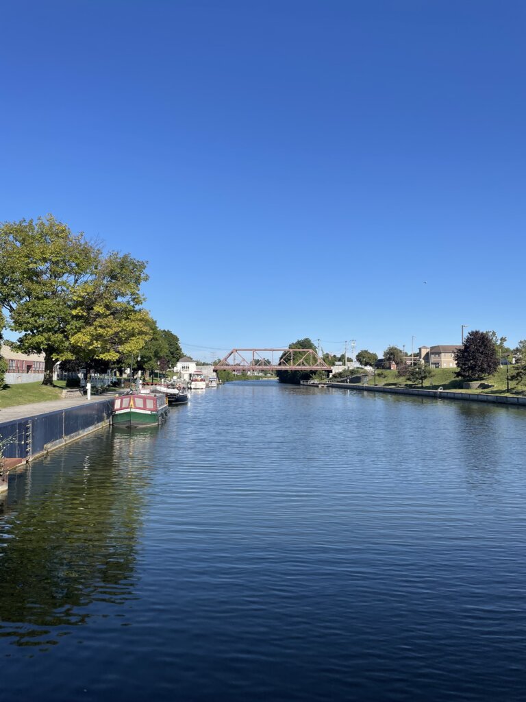
You have a few options when taking a boat from the Great Lakes to the ocean. You can take the Mississippi River, the St. Lawrence Seaway, or the Erie Canal. We are heading to the Bahamas and the Eastern Caribbean so the Mississippi didn’t make sense. The St Lawrence Seaway puts you a lot further north than we wanted to go this tip so we chose the Erie Canal.
The Original Erie Canal was completed in 1825. It was designed as a ditch filled with water. Mules or horses would walk along the towpaths on either side, pulling barges. Since the canal was such a success it was enlarged and then enlarged again to the present day canal. Today, the Erie Canal is 295 NM (340 statute miles) through the state of New York. It contains 35 locks and 16 lift bridges. The lift bridges all rise to a height of 15.5 ft.
We really enjoyed our journey through the canal! There are plenty of places to tie off for the night. Many places are free and offer electric and water. There are also many places with free pump-out along the canal. We used Skipper Bob’s Guidebook and found that to be very helpful. Many of the stops are right in town so you can walk to stores and restaurants. There are also many stops away from town if you are looking for a quiet setting.
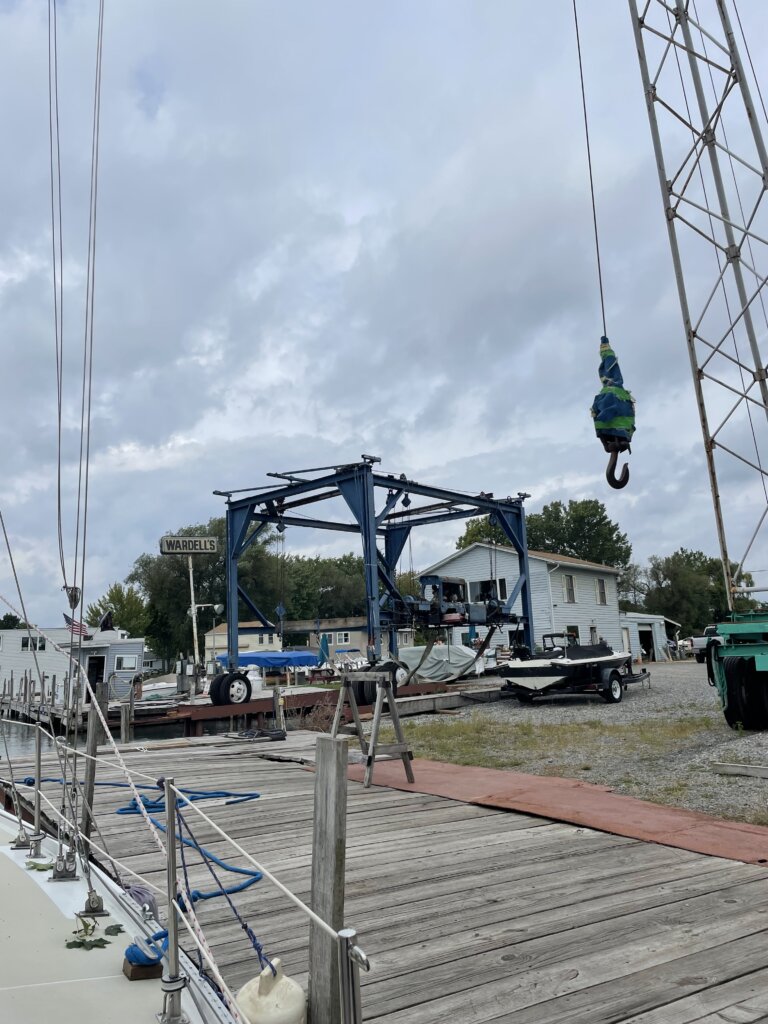
Traveling from west to east you will enter the New York Canal System at the town of Tonawanda. Wardell’s Boatyard is where most people have their mast stepped if traveling by sailboat. The boatyard is along the canal right before the first low bridge that you won’t be able to get under with the mast up. You can tie up on the free wall across from the yard. The wall is metal and doesn’t have any cleats or bollards to tie to. There are holes near the top of the wall you can run a rope through and then back to the cleats on your boat. While here waiting for your mast to be stepped you will find a very close grocery store and wine/liquor store. Advance Auto Parts store is also close by if needed.
We were expecting to have to wait a day or so but as soon as we arrived Wardell’s said they could step our mast that day. We promptly got the sails down and everything ready. There is old lumbar from previous boats that you can use to build your mast cradle. Wardell’s staff basically found old cradle pieces that worked for our boat and put the whole thing together for us. The total cost was $10 a foot (of the mast) and $100 for the cradle.
The following day we began our journey down the canal.
Day 1: Tonawanda to Lockport
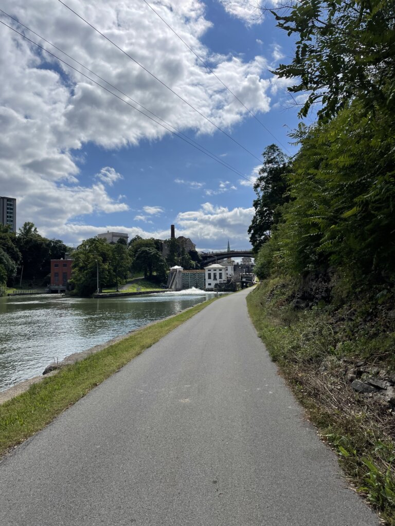
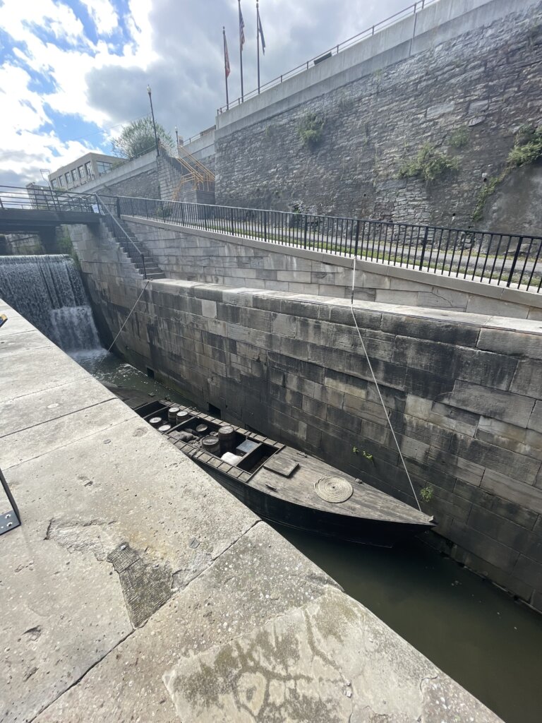
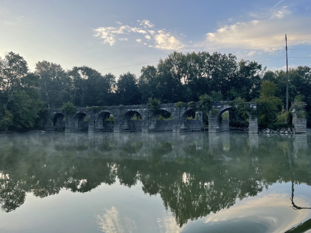
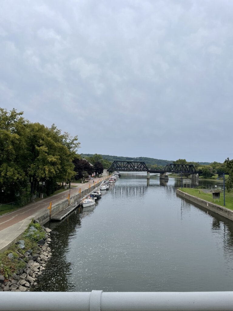
We chose to only go 18 miles to Lockport one day one. We stayed at the park on the north side just after locks 35 and 34. These two locks are a pair. You immediately enter 34 when they open the doors in 35. We found there to be a lot of current pulling our boat back and forth when the doors opened so be prepared for that. Each lock drops you down 25 ft. Once tied off along the wall at the park there is a nice walk up to town along the locks. Lockport originally had two sets of 5 locks when the canal was built. You can see one of the old sets of 5 original locks as you walk up to town. The entire town is centered around the locks.
Day 2: Lockport to Spencerport
The western half of the canal is where pretty much all of the lift bridges are located. Day two on the canal we went through a total of 15. We didn’t experience any delay, whenever we hailed a bridge on the radio they were ready and began lifting for us. We stopped in Holley for lunch and to see the waterfall. Along the south side, there is a free, wooden dock with electric and water. It is a short walk to the park to see the Holley Falls. The park and the waterfall are both beautiful. We would highly recommend this as a stop or an overnight stay.
After lunch, we continued on to Spencerport. We traveled a total of 49.2 miles. In Spencerport, you can tie along either the north or south side. North is deeper, we read the south side is about 4.5 ft deep. There is electric on the north side and bollards to tie to. The south side has electric, water, and cleats to tie to. We found a really good ice cream shop close by. There are also several restaurants in town we were told were very good.
Day 3: Specerport to Newark
The following day we headed all the way to Newark, 44.5 miles. We passed a few small towns, Pittsford and Fairport both looked very cute. We didn’t stop as we wanted to keep going for the day. The wall at both these towns has plenty of room for boats. Fairport is a popular stop and the walls there were quite full when we passed by. There is a fee to stay in Fairport.
We arrived late afternoon in Newark. Here there is a free wall, free wifi, power, water, and laundry along the north side. You should check in with the office when you arrive and they will give you the code as well as information on the town. The facilities were very clean and nice. While it isn’t the cutest town in this section of the canal we felt it was a great stop due to all the amenities for boaters.
Day 4: Newark to May’s Point/Lock 25
We chose to do a shorter day the following day, we traveled 22.5 miles and stayed along the wall just after lock 25. The wall is high and there are no services. It was quiet, nothing around but we enjoyed the peaceful evening.
Day 5: May’s Point/Lock 25 to Brewerton
The following day we got up early and went 53 miles to Brewerton. Before getting to the free wall in town we stopped at Winter Harbor Marina at their self-service gas/diesel dock. Diesel was at least a dollar less here than anywhere we had seen in a while- $3.79 a gallon. We spent the night on the south side in between the bridges. There was noise from the train when it went by and some boat traffic during the late afternoon. It quieted down in the evening and overnight. The dock is nice and has cleats to tie to. No electric or water here. This brought us past the halfway point. We entered the eastern section of the canal the next morning.
Day 6: Brewerton to Lock 20
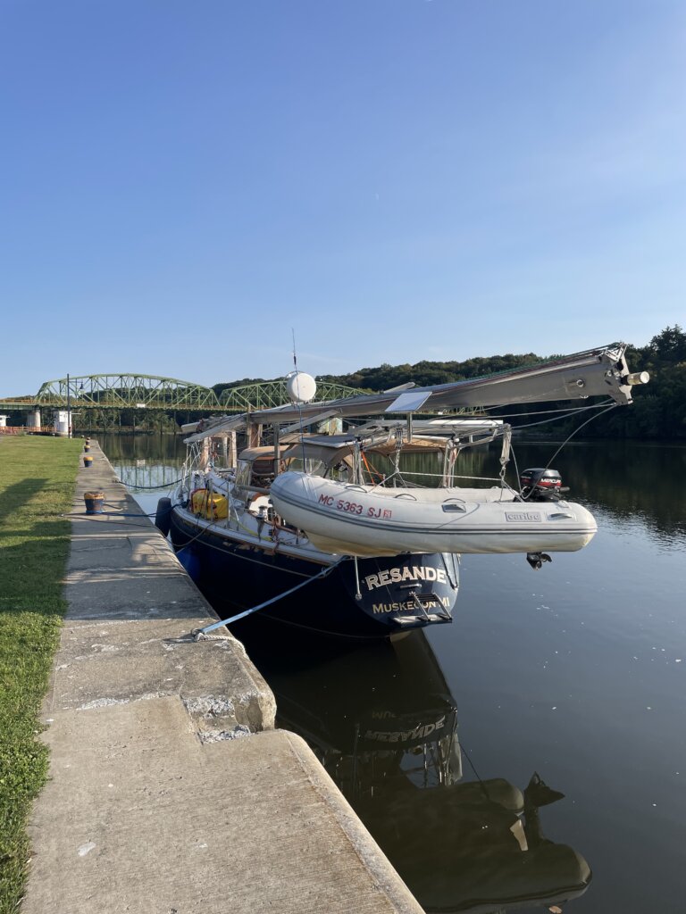
We headed from Brewerton to Rome where we were hoping to stay the night and explore the city. Our Skipper Bob book did say to check charts as the depth had been reported as 5 ft. We checked the charts and saw shoaling from the west but right at the wall, the chart said 10 ft. When we arrived there were several red buoys on the west side, we assumed that was where it was shallow. It got shallow very quickly as we approached the dock and we got stuck hard aground. We were not able to reverse off. We had to drop the dinghy off the davits and use it to tow Resande off the mud. That did work and we were then able to continue on. We stayed the night on the wall just east of lock 20 instead. It was quiet, no services on the wall but exactly what we needed after our eventful day!
Day 7: Lock 20 to Little Falls/Lock 17
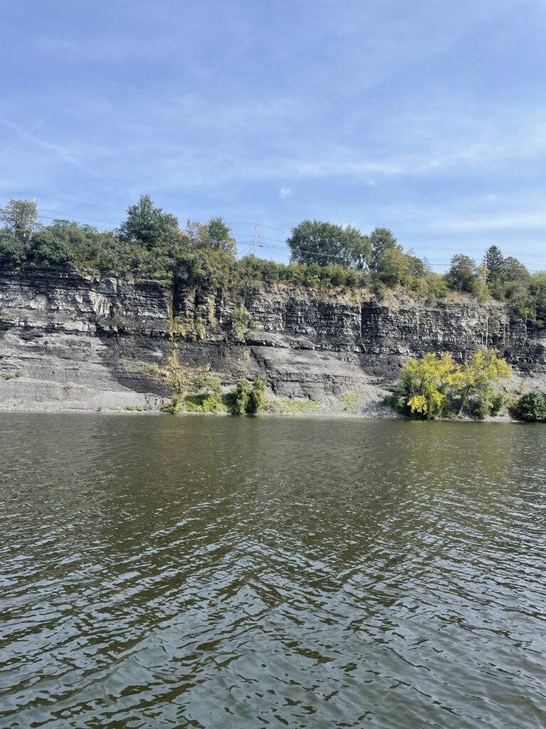
After going further than planned the day prior, we had a shorter day, 26 miles. We stayed on the wall for free just past lock 17. You can stay right in town at Little Falls but it is $1 per foot last we read. We finally ran into other sailboats transiting the canal and heading south! There were 4-5 other sailboats tied up on the wall when we arrived, still, we had plenty of space. The canal from lock 20 to 18 is shallower with a lot of shoaling. We used the following link as our guide- Eastern Canal Water Published Depths. It shows the last known depths at the North/Middle/South of the canal. We draw 6 feet and between Rome and Lock 18 we touched the bottom 3 times. We had our eyes glued to the depth sounder for most of that time since we were seeing depths 6-7 feet most of the way. The website above will at least tell you which side to favor for the best chances to get through. For the most part, it was pretty accurate. Also, they were dredging just east of Lock 19 as we went by, we had to pass close to the dredging equipment on the north side, and it was easily 9-10’ the whole way to the lock. Generally, wherever there is a river confluence, there is usually a bad shoal on the side of the river.
Lock 17 is the largest lock on the canal. It lifts or lowers 40.5 ft. It is also one of only two locks in North America where the guard gate lifts over the boater. You will get wet as you leave the lock and pass under the gate.
Day 8: Rest and Explore in Little Falls
We decided to take a day off and explore more around this small town. There are many historical buildings in town to see. You will also cross over the river and see the falls as you enter town from the lock. We really enjoyed lunch at Mangia Macrina’s Wood-Fired Pizza. We highly recommend it if you stop here! In town, you can also find groceries, wine and liquor, and a hardware store.
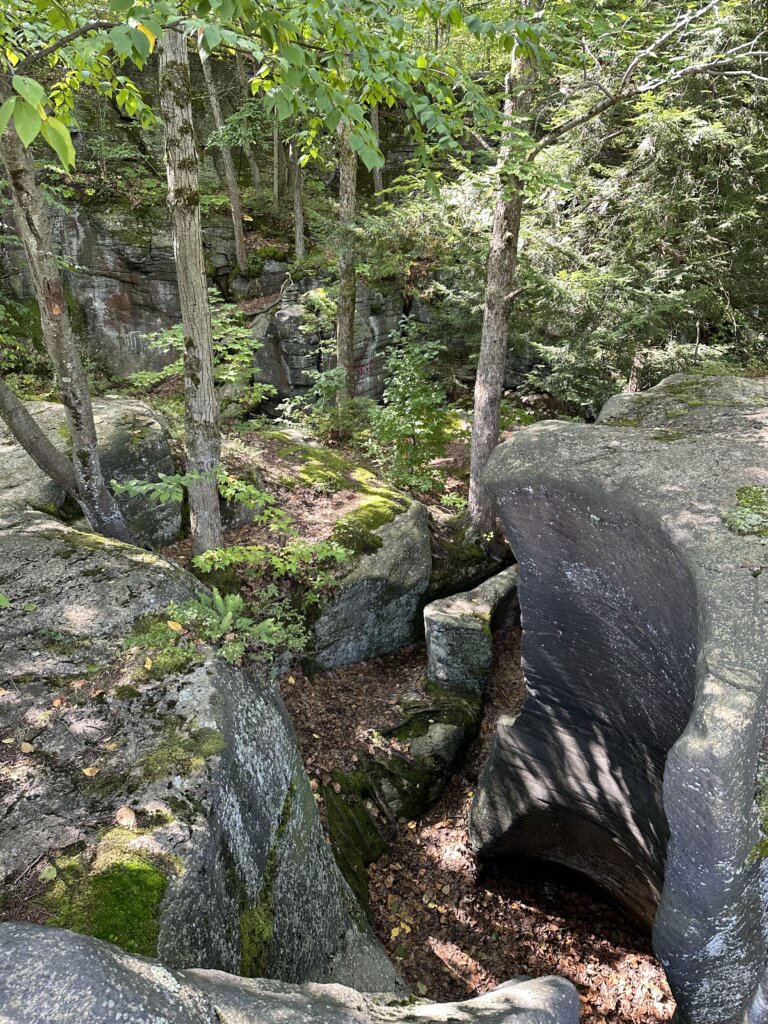
The other highlight for us here was exploring Moss Island. This unique island is known for its large 40-foot-deep potholes (rock formations), the island is covered in dwarf oak trees. It’s beautiful to hike through. You can see glacial striations in the rocks in some places on the island. Some of the rocks are tagged with graffiti which is unfortunate but overall still well worth a visit!
Day 9: Little Falls/Lock 17 to Lock 11
We traveled 40 miles on this day. Much of it through rocky hills, very pretty. The locks along this stretch are all adjacent to dams as the canal runs through the Mohawk River. The lock walls are also much shorter and curved. We found our fenders weren’t helping when we approached the locks (they were too high with these lock walls). In Lock 12, we scratched the boat while grabbing the lines in the lock. We significantly lowered the fenders after that! We stayed along the wall on the north side at the top of lock 11 that night. There is electric but no water or pump out available.
Day 10: Lcok 11 to Crescent
We waited until the fog lifted and then headed off. This section of the canal was very pretty with rocky walls along either side much of the way again. The lock walls went back to what we had experienced originally, taller and not curved making it easier to approach without scratching the boat. We had a slight delay at lock 7 due to a mechanical issue but they quickly got it fixed and we were on our way. We made it 34 miles to Crescent where we tied up to the free wall for the night, no services here. The following day we finished the last few miles of the canal!
Day 11: Crescent to Wartford
We transited the Waterford Flight to finish off the canal. You do need to arrive at this section at least 90 minutes before closing time for the day as you can’t stay in between these locks. This set of locks includes locks 6-2. These locks are known for raising/lowering a boat the greatest amount in the shortest distance in the world- 169 ft in 2 miles! Before getting to lock 6 you will arrive at Guard Gate 2. This gate is typically closed so you may need to call on channel 13 to have it raised. Once it was up the first lock quickly followed as was ready for us. The locks are so close that once you leave one the next lock will likely be ready for you to enter. We had two other boats with us and in total, it took us about 90 minutes to complete the flight.
We landed just after lock 2 in Waterford where we stayed for two nights to relax, clean the boat, and re-provision. The fee here is $10 a night and that includes electric and water. You can pay an additional $5 for the bathroom/shower code. The grocery store in town will allow boaters to bring a cart back to the docks and they come by to pick them up every so often so you can leave the cart by the visitors center when you are done. The grocery store here was very well stocked! one of the best we had seen since we left our home port. There is a farmers market on Sunday mornings right along the waterfront which we were very glad we could catch.
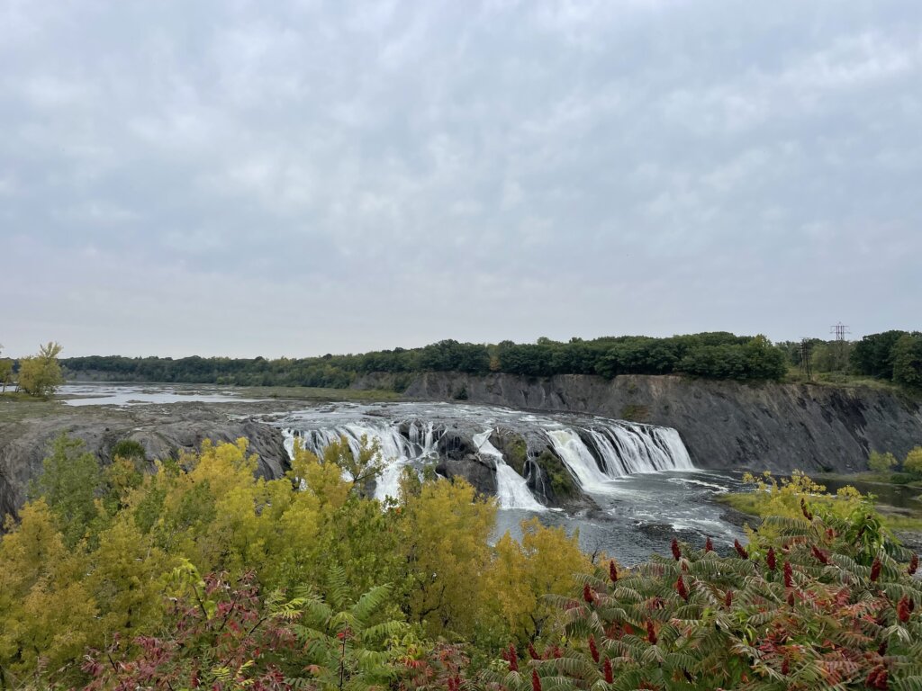
The other highlights for us near Waterford were Cohoes Falls and Peebles Island State Park. Cohoes Falls is the second-largest waterfall in the state of New York. It is 2.7 miles from the waterfront and we found the walk to be well worth it! Peebles Island is very close to the waterfront. You can walk the perimeter trail of the island. You will get great views of the river along the way. The total perimeter is 2.4 miles.
Helpful Hints When Transiting The Canal:
Use gloves when locking, the lines are slimy. We had purchased these gloves for sailing in cold weather but they also worked great for the locks. The longer length of them kept us clean and they wiped off well once we were through the canal.
There can be a strong current in between the double locks (35-34) when the doors open after the first lock. This is the only double lock set. We had no trouble with any of the other locks.
All bridges and locks use VHF channel 13. They will likely ask you how far you are going each day and let the upcoming bridge or lock operators know so they are ready/expecting you.
The bridge operators often operate more than one bridge so you may have a short wait.
There won’t be anyone in the lock to help with your lines. The locks all have ropes you can grab onto and hold as you rise/lower. A few of the locks will also have cables. The lines have weights on the bottom but aren’t connected to the bottom of the lock
Significantly lower your fenders after Lock 17. The walls are angled differently and much lower so on our boat when we went to grab the lines our fenders (which were in a good place for all previous locks) were not protecting the boat. We didn’t lower our fenders after lock 16, not sure if they would all be this way and we scratched the boat.
You really need a couple of larger fenders but the ball fenders aren’t necessary. A few people we talked to were going to buy ball fenders specifically for the canal but if you have larger fenders you will be fine.
Take your time and enjoy your trip down the canal!
We had been hearing for years “You have to go to the North Channel, it’s Amazing!” Everyone says it’s beautiful and a must-visit but we never had time to get there and back until this summer on our way out of the Great Lakes. After our journey in Lake Superior, we headed east, into the North Channel. From Sault St. Marie our first stop was in Milford Haven. We spent one night here and woke up early the next morning to head across the channel, officially into the North Channel anchorages!
Turnbull Island
This was our first anchorage in the North Channel. It’s a nice anchorage with plenty of room. There are many outer islands to explore by dinghy or paddle board. The beach in the anchorage also has a grill, fire pit, and picnic tables. We enjoyed our time here and met several other cruisers. It was nice to get some information and recommendations from people who have cruised the North Channel before.
Beardrop Harbour
This place is stunning! It’s a popular spot but there is plenty of room. We were anchored with about 8-10 other boats the few nights we stayed and everyone was well spaced out. We anchored near the small cut going out to Whalesback Channel. This was perfect for dinghying and paddle boarding out into the channel and back into the anchorage. There is plenty to explore here. We found plenty of blueberries on the islands! There are also many bald eagles in the area! We even saw a little mink running across the shore! One of our favorite spots we visited for sure!
Moiles Harbour
This anchorage is only 6 miles from Beardrop, across the Whalesback Channel. It’s a beautiful sail between the two anchorages. The Sudbury YMCA owns the land around the anchorage but we read that they don’t mind cruisers anchoring as long as you respect the land and water and don’t have bonfires. You can see the ruins of an old sawmill in the bay. The bay is quite large with room for several boats. There are plenty of small, rocky islands to explore. While this anchorage was nice, we felt it was only necessary to stay one night and then keep on moving.
Shoepack Bay
We were told by some other cruisers that this is one of their favorite stops so we were excited to check it out! The bay is deep and there are not many suitable spots to anchor. When we arrived there were two boats stern-tied in the perfect, 20-25ft deep spot. We drove around a bit but couldn’t fit a spot where we felt comfortable stern-tieing. There was also a pretty strong blow forecast the following day so we decided to continue on towards an anchorage we knew we’d be safe in. If you can get a spot here it would be a lovely place to stay! There are beautiful rock cliffs along the northern edge of the bay. Beautiful to drive through as well even if you don’t plan to stay.
Eagle Island
We anchored in the large bay on the northeast side of the island. This is a very large bay with plenty of room. It’s beautiful, with a small rocky island in the center. We enjoyed paddling along the shore around the bay. We were planning to stay here more than one night, to ride out a big blow but the forecast was down-graded so we decided to move on.
Fox Island/Fox Harbour
This place was another one of our favorite stops! We would highly recommend it if you can get a spot! Towards the end of the channel, there is a large opening/pool that 2-3 boats could swing on anchor. We chose to stern-tie along the rocky shore in the channel as two boats were already anchored in the pool. We absolutely loved this spot! We were on the other side of some rocks so we basically had the place to ourselves, unable to see the other two boats. There is a labyrinth of small, rocky channels to explore! Perfect for paddle boarding or kayaking. Entering on a calm day is highly recommended. The channel is about 250 ft wide at its narrowest with rocks and shoals to look out for as you enter.
South Benjamin Island
This island is one of, if not the most popular stop among cruisers in the North Channel. This island is beautiful and the rocky hills are not too steep so there is plenty to walk around and explore! There are two major anchorages on the island and then several, smaller coves you could stern-tie or spider-web into. We stayed in the southwest anchorage. There were at a maximum, 10 other boats in the anchorage. Everyone had enough room but we were definitely closer to our neighbors here than in other anchorages we had visited so far. Although more crowded, this island is worth a visit! We really enjoyed our time here.
You can also explore North Benjamin from Fox Island or from South Benjamin. The north island is more heavily forested but we found several very pretty, rocky spots to walk along the shore.
Crocker Island
The is the last island in the Benjamin Island group. There is a large bay you could anchor in but be prepared- it is about 40ft deep throughout. We chose to duck into the small bay behind the small island. This smaller bay is about 15-20 ft deep with plenty of areas to stern-tie. We arrived late in the afternoon and there were already 4 boats in the smaller bay. It was pretty tight but we found a place to stern-tie and still give everyone enough room. The hills on this island are higher and steeper. We found fewer hills we could walk all the way up but there is still plenty to explore! And, plenty of mink swimming and running along the shore here!
Little Current
The small town of Little Current is in a perfect location for re-provisioning during a North Channel trip. We stopped in for the afternoon but there is plenty of dock space if you wish to spend the night. From what we could gather online ahead of time, you can leave your boat on the wall for free during the day, it isn’t until you spend the night that they charge you. We arrived mid-morning and grabbed a spot along the wall. We found water available at this spot so we filled the tanks, emptied our trash, and headed into town. A few marina staff walked by and nobody told us we needed to pay so as far as we know we didn’t break any rules!
A short walk from the docks there is a Value Mart for groceries and an LCBO for wine, beer, and liquor. The grocery store was pretty well stocked but oddly organized. We did end up finding almost everything on our list. After shopping we headed to The Port for fish and chips. The portions were generous and the food was excellent!
From there we headed back to the boat, waited until the top of the hour, when the swing bridge opened, and then headed out towards our next anchorage. The swing bridge opens on the hour for 15 minutes as long as there is a boat waiting, no need to radio, just don’t miss the opening!
One more note on Little Current- we were told by many cruisers the current is no joke! We couldn’t find an online bouy or anything to tell us real-time current conditions. When we were there we found the current to be about 1 knot going from west to east. If it has been a strong wind for several days this may get worse.
Mary Ann Cove/Baie Fine
We tucked into Mary Ann Cove to ride out a blow. Baie Fine is a beautiful fjord and well worth a visit! Mary Ann Cove is a perfect, very well-protected spot. From the cove, you can hike up Casson Peak. The hike starts at an old dock and the trail is well-marked with ribbons. The views from the top are incredible and the hike itself is very pretty!
The Pool/Baie Fine
The drive up the fjord is wonderful. The pool is a beautiful anchorage with plenty of hiking. It is weedy but we held well, just be prepared to clean off your anchor when you pull it up! From an old dock on the north shore, you can access trails that are part of Killarney Provincial Park. The hike to Topaz Lake is a must. This is the highlight of this anchorage. Do not miss it! We also hiked along part of the La Cloche Silhouette Trail to Artist Lake and then to Cave Lake. This trail is a nicer overall hike than the path to Topaz Lake. Artist Lake and Cave Lake are both very pretty but Topaz is definitely the prettiest. Topaz Lake is also clear enough that we jumped in. The other two lakes we wouldn’t want to swim in.
Covered Portage Cove
This is another very pretty anchorage! It is shallow, depths are about 7-10ft throughout. There are tall, white cliffs along the edge that you can hike up to get great views of the anchorage! We also saw otters and beavers along the shores. This is a popular spot so chances are you won’t have it to yourselves. We were the 11th boat when we arrived but people came and went, we never had more than that. There is plenty of space and there is an outer anchorage as well if it’s too crowded for you.
Killarney
We were told by several cruisers to stay at the Killarney Mountain Lodge. A slip costs $2 Canadian per foot plus a $10 fee for use of all of their amenities. There is a pool, sauna, and free laundry (although only one washer and one drier). The lodge also has several restaurants on-site. We also really enjoyed the short hike to the lighthouse from the property. It really is a nice place to stay after being anchored out, away from towns, stores, and restaurants for so long. There is not much in the town itself. We did find a general store that although overpriced had some food and essentials if you need them. There is not a proper grocery store. There is an LCBO for beer, wine, and liquor.
That concluded our time in the North Channel. From Killarney, we continued into the Georgian Bay. There are many, many, more beautiful spots to anchor and explore within the North Channel. You could spend many summers finding new anchorages!
A few random notes- paddle boards or kayaks are a great way to explore here. We used our paddle boards much more often than our dinghy. It’s easier to land the paddle boards or kayaks on the rocky shore and it allows you to explore more places and small channels/coves that the dinghy may not fit. If you have and can bring both, you will likely use both, if you have to choose we would recommend paddle boards or kayaks. At first, we were not impressed with the water clarity in the North Channel but we found it improves the further east, towards the Georgian Bay you go. Lastly, although having stern-tie line isn’t necessary we did find that it opened up more possibilities and we were very glad we had it with us.
Enjoy your trip through the North Channel! Take your time and soak in the views!
Before we headed out of the Great Lakes with Resande we wanted to explore as much as we could. Lake Superior sparked our interest as we have always found it beautiful when we have traveled there in the past.
We became curious about the Canadian coast since we had already traveled much of the U.S., Michigan’s upper peninsula coast via car/camper trailer. We quickly found that there are not a lot of cruisers who travel this coast so information was sparse. We kept reading that Bonnie Dahl’s book The Superior Way is a must. But then we found it is out of print and very expensive to purchase. We continued looking online for any information and did find a very helpful post on a cruisers forum- Lake Superior cruising advice. With this and some old Great Lakes Cruising Club information we copied from a binder in our marina library before leaving the dock, we set off.
After heading up the St Mary’s River we spent one night in the marina on the U.S. side of Sault St Marie. The next morning we checked into Canada and went through the Soo locks on the Canadian side of Sault St Marie. From there our first stop was in Batchawana Bay. We made it up the coast all the way to Otter Cove before turning around and heading back south.
Batchawana Bay
This is most likely going to be your first stop unless you plan an overnight sail to an anchorage further up the coast. This is a large bay with plenty of places to anchor. We found it to be good, sand holding. It is very well protected from anything but an east wind. There are some buildings along the bay, we didn’t dinghy to shore here so not sure exactly what there is available. It’s a nice stop after getting up the river and through the lock.
Harmony Beach
The next morning we headed further into this area, past Batchawana Island, and anchored in Harmony Beach, just about 5 miles away from our anchorage the night before. Again here is nice sand holding. It is very shallow and sandy close to shore so you do need to anchor a bit further out. This is a beautiful spot right along the coast of the island. It’s a nice place to dinghy around or paddleboard. We were hoping to get a hike in but found that there is no hiking on Batchawana Island, we tried and it is very thickly forested and very, very buggy! We did walk briefly along the shore, seeing some very large animal prints in the sand along the way.
Sinclair Cove
Our next stop was Sinclair Cove. This was our first real wilderness anchorage. It is stunning and we highly recommend it! From the cove, you can take a short hike to visit the Agawa Rock Pictographs. The pictographs were drawn on the rock by the Ojibwe somewhere between 150 to 400 years ago. One of the creatures drawn on the rock is the Mishipeshu- the great lynx. You will need to walk along the rock wall to see pictographs. There are some chains to hold onto as you head out along the edge of the rock. This should be done on a calm day, in large waves this wouldn’t be possible. There are several small, rocky islands around the entrance to the bay which are great to dinghy around and explore. We also saw several bald eagles during our time here.
The anchorage is small. We were alone in the bay until later in the evening when a power boat did come in and stern tie to shore along one of the rocky islands near the entrance. The bay itself has space for maximum 2-3 boats with room to swing on anchor. We had read that the ground here is hard-packed sand, almost concrete-like, and difficult to get an anchor to set. Our 55lb Mantus anchor did slightly dig in and set without backing down much. We have all chain as well so we stayed put for the night. In a strong blow, this would not be a great anchorage.
Gargantua Harbour
We didn’t have much information on this anchorage but it looked like a well-protected anchorage on Active Captain and it was a good distance for a jump from Sinclair Cove. We found it to be good holding, and safe from wind in any direction. We ended up really enjoying our time here. You can hike along the Lake Superior Coastal trail from Gargantua Bay to Warp Bay. It’s a very nice hike through the forest, and towards the end there is a waterfall. Warp Bay is beautiful and there is a large beach here to walk/explore.
We did run into two park rangers during our hike, they politely told us that we should have a park permit to use the trails since this is part of the Lake Superior Provincial Park. Permits can be purchased online. We told them we could do that from the boat and they had no problem letting us continue on with our hike. The next two bays we went to were also within the park boundaries. Anchoring is no problem but once you set foot on land to use the trails, you should have a permit is what we were told.
Gargantua Bay also has a shipwreck that is submerged just under the water. Part of the ship was just barely sticking up when we were there. Ryan did dive on the wreck, the water was 52-54*F while we were here in July so definitely not warm!
In Gargantua, you can also see the remains of an old fishing shack along the edge of the bay and some old gardens or greenhouses. There was at one time a small fishing village here.
On the way out of the bay, continuing north along the coast, you will sail past Devil’s Warehouse island where there is a cave that is said to be where the ocher plant that was used to paint the Agawa pictographs was found. We opted not to sail through Tug Boat Channel due to hearing the depth was shallow in parts but we read other blog posts from people who did sail through and got amazing views of the Devil’s Chair rock formation.
Brule Harbour
The entrance to this anchorage is stunning! It is an amazing anchorage but be aware of deadheads! We saw at least one very large tree floating in the water as we were trying to anchor. Be sure to use a trip line. We got our anchor up with no problem but we did have a very large branch tangled in our trip line. We were able to get it untangled with a boat hook. There is plenty to dinghy around and explore in this anchorage and you are very well protected from wind in any direction. This may have been our favorite anchorage of the trip!
We actually met another boat here. A tug boat from the Georgian Bay. We had a nice chat with this older couple in the evening. They had been on their trip for 40 days, they went straight across to Thunder Bay and were slowly working their way back. They shared some great intel on our upcoming anchorages.
Old Woman Bay
While we were anchored in Brule Harbour we took the dinghy to Old Woman Bay. We had read it is a great place to drive through, beautiful but no anchorage. There is a large cliff face along the edge of the bay that drops straight into the water. After taking time to dinghy past that and take lots of pictures, we landed the dinghy on the large beach and headed to shore for a hike. Across the street from the parking lot here is Nokomis Trail. This 5K loop offers several great lookout points with amazing views of the bay.
Otter Cove
We had heard great things about this anchorage! There is a lot to explore here! It sounds like this is a more popular anchorage from what we read but once again we had the place to ourselves! On a calm day, you can dinghy over to Cascade Falls which dumps right into Lake Superior. If you are willing to scrabble up the rocks a bit you can see a pool in between the upper and lower falls. It’s a beautiful sight and we would highly recommend seeing it!
Old Dave’s Harbour
Old Dave’s is located on Otter Island, very near Otter Cove. We visited Old Dave’s with the dinghy while we were anchored in Otter Cove. We read mixed reviews on if we could safely get our 6ft draft sailboat back here so we decided not to risk it! After going through with the dinghy we feel it would maybe be doable but there is shoaling along each side of the entrance which would make it tricky.
Once inside Old’ Daves, there is an old dock to tie the dinghy to along the shore. There are some old coast guard buildings near the dock. You can walk along a trail supposedly all the way to the lighthouse but it quickly became very overgrown so we ended up dinghying around the island to the lighthouse. There are plenty of rocks to walk around and explore on the outer side of the island! This is a very pretty spot!
Otter Cove ended up being our furthest north anchorage. We had debated continuing on to Allouze Island and the Slates but the weather forecast didn’t look great for that. We read the anchorages in the Slates are all very deep and we didn’t see any hiking trails on AllTrails. We have heard the Slates are beautiful but we ultimately turned back south to explore some different areas with more hiking and things to see.
Quebec Harbour Mitcipicoten Island
This is another more popular anchorage base on what we had read. We saw three other boats here in total and a few small fishing boats. On our final night here we had a lovely cocktail hour and dinner aboard SV Victoria Jean, making new friends who hopefully we will see again on the water someday!
In Quebec Harbour, there are three visible shipwrecks in the anchorage. We struggled to find much information on them when we looked them up online. Two of the wrecks are above water, the third is submerged. Along Davieaux Island at the entrance to the harbour, there is a nice trail that takes you up to the old lighthouse. There is an old dock to tie the dinghy up while you explore. The views out to Lake Superior here are stunning!
There is also an old, abandoned fishing village in the anchorage. We wandered around exploring what we could. There is somewhat of a trail but everything is very overgrown. There are no formal trails on Mitchipicoten Island and from what we could see it looks very thickly forested so we only explored close to shore.
We were hoping to get a glimpse at some caribou while we were in Quebec Harbour but we had no such luck! We did see many, many ducks and loons swimming in the harbour and a few bald eagles. This anchorage has great holding, sand bottom, and is protected from the wind in all directions. We were told by some fishermen that there is good pike and trout fishing but we didn’t try our luck at it.
Resources
There is not much in the way of cities/towns/resources along this stretch of coastline. We were told that Buck’s Marina in Wawa will have fuel, diesel, water, and pump out. We read and were told the people at Buck’s are willing to help with whatever you need if they can.
We didn’t actually need to reprovision during our time along this coast of Lake Superior. We carry 80 gallons of diesel in our tanks plus three jerrycans. We filled our dinghy gas tank and had one extra jerry can for that. We have a composting toilet so we don’t need pump out. We did a big grocery run in Sault St. Marie so we were well stocked on this trip. We carry 115 gallons of water in our tanks. Given the number of filters we have onboard, we felt fine with filling our tanks with Lake Superior water as we began to run low.
In our research before this trip, we kept hearing this coastline described as wilderness sailing and that is exactly what it is. The scenery is stunning! You will most likely have these amazing anchorages to yourself. But you need to come prepared and have what you need onboard.
If we had more time we would have loved to keep going north, further along the coast. Our goal is to leave the Great Lakes and head out the Erie Canal so we had to get going back south. This is definitely a place we would love to return to and cruise again someday!